1
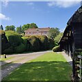
House and pasture at Netherton
Looking west south west from the road from Coombe to Netherton, on the northern edge of the latter hamlet.
Image: © Peter Jordan
Taken: 22 Jul 2006
0.01 miles
2
Pasture north of Netherton
A cloudy evening after heavy summer storms.
Image: © Peter Jordan
Taken: 22 Jul 2006
0.01 miles
3
Netherton, Faccombe
Netherton House and cottages viewed from the field with earthworks above the hamlet.
Image: © Andrew Smith
Taken: 25 Oct 2009
0.02 miles
4
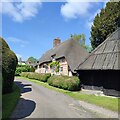
Netherton Cottage, Netherton, Hampshire
Late C18. Flint and brick, with a thatch roof. The front (south) is of 1 storey and attic, with 2 (later) dormer windows with cills at eaves level and 2 small (original) windows just below the eaves, 3 ground-floor windows. Roof ½-hipped at the west end, with eyebrow dormer openings, hipped at the east and extended to a low eaves above an outshot. Flint horizontal (8) panels with brick quoins, cambered arches; thin projecting 1st floor band: the outshot being boarded. Casements. Boarded door beneath a gabled canopy on brackets. To the west of the doorway is a VR wall post-box.
(Source:Historic England)
Image: © Oswald Bertram
Taken: 10 Jul 2015
0.02 miles
5
Netherton House
Image: © AJD
Taken: 1 May 2023
0.02 miles
6
Netherton Cottage
Image: © AJD
Taken: 1 May 2023
0.02 miles
7
Netherton godcake
A godcake at a junction between Heaven Hill Road leading west (left) and Netherton Road leading north and south (right) in the hamlet of Netherton.
Image: © Oscar Taylor
Taken: 17 Sep 2023
0.04 miles
8
Netherton Farm
This beautifully kept farm is at the intersection of Netherton and the road to Faccombe. The square contains the village of Netherton and farmland used for agriculture and pasture. The picture shows the barns to the right, the entrance to the left and the farm house in the distance.
Image: © Pam Brophy
Taken: 2 Oct 2005
0.08 miles
9
Lane junction at Netherton
To the right is Faccombe. Whilst the wall ahead belongs to Netherton Farm.
Image: © Stuart Logan
Taken: 20 Oct 2011
0.10 miles
10
Path to the east of Manor Farm, Linkenholt village
To return to Faccombe from Linkenholt on foot, the most direct approach is to leave the Test Way and follow this path back via Netherton.
Image: © Peter S
Taken: 20 Oct 2012
0.24 miles


