IMAGES TAKEN NEAR TO
SO5 8NZ
Introduction
This page details the photographs taken nearby to SO5 8NZ by members of the Geograph project.
The Geograph project started in 2005 with the aim of publishing, organising and preserving representative images for every square kilometre of Great Britain, Ireland and the Isle of Man.

There are currently over 7.5m images from over14,400 individuals and you can help contribute to the project by visiting https://www.geograph.org.uk
Image Map
Images are licensed for reuse under creativecommons.org/licenses/by-sa/2.0
Notes
- Clicking on the map will re-center to the selected point.
- The higher the marker number, the further away the image location is from the centre of the postcode.
Image Listing (49 Images Found)
Images are licensed for reuse under creativecommons.org/licenses/by-sa/2.0
Image
Details
Distance
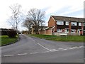
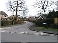
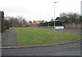
2
Addison Close, Woodley estate
Off Winterborne road next to Sutherland Close
Image: © John Firth
Taken: 17 Mar 2012
0.07 miles
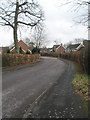
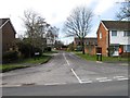
3
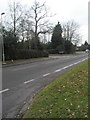
Looking towards the junction of Cedar Lawn and Braishfield Road
Taken from the junction with Winterbourne Road.
Image: © Basher Eyre
Taken: 19 Feb 2009
0.07 miles
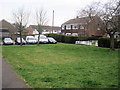
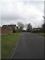
4
Junction of Winterbourne Road and Beverley Gardens
Image: © Basher Eyre
Taken: 19 Feb 2009
0.07 miles
8
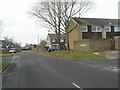
Junction of Winterbourne Road and Pinewood Close
Image: © Basher Eyre
Taken: 19 Feb 2009
0.10 miles
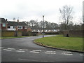
10
Junction of Winterbourne Road and Braishfield Road
Image: © Basher Eyre
Taken: 19 Feb 2009
0.10 miles