IMAGES TAKEN NEAR TO
Proctor Drive, SOUTHAMPTON, SO52 9NG
Introduction
This page details the photographs taken nearby to Proctor Drive, SO52 9NG by members of the Geograph project.
The Geograph project started in 2005 with the aim of publishing, organising and preserving representative images for every square kilometre of Great Britain, Ireland and the Isle of Man.

There are currently over 7.5m images from over14,400 individuals and you can help contribute to the project by visiting https://www.geograph.org.uk
Image Map (Loading...)


Getting Data...Please wait
Leaflet Map data © OpenStreetMap
Images are licensed for reuse under creativecommons.org/licenses/by-sa/2.0
Notes
- Clicking on the map will re-center to the selected point.
- The higher the marker number, the further away the image location is from the centre of the postcode.
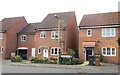
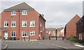
Image Listing (11 Images Found)
Images are licensed for reuse under creativecommons.org/licenses/by-sa/2.0
Image
Details
Distance
1
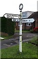
Old Direction Sign - Signpost by Rownhams Lane, North Baddesley
Annulus finial - 3 arms; Hampshire Parish halo by the UC road, in parish of North Baddesley (Test Valley District), junction of Rownhams Lane with Rownhams Road, in front garden.
To be surveyed
Milestone Society National ID: HA_SU3919
Image: © Milestone Society
Taken: Unknown
0.08 miles
2
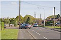
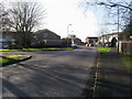
Junction of Rownhams Lane and Rownhams Road
Road is on left; Lane behind and ahead.
Image: © Peter Facey
Taken: 2 May 2008
0.08 miles
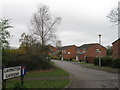
4
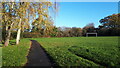
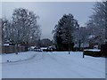
Autumn morning at Lavington Gardens Playing Field
Image: © David Martin
Taken: 25 Nov 2022
0.12 miles
5
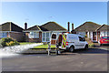
Flushing the water main
Water running to waste to clean out the water main here. So said the man when asked.
Image: © Robin Webster
Taken: 7 Feb 2017
0.13 miles
6
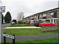
Sylvan Drive
Sylvan Drive heading to Ringwood Drive
Image: © Shaun Ferguson
Taken: 30 Jan 2013
0.21 miles
10
Bend in Thomas Road
This whole area used to be the site of Borden Chemicals. Straight ahead used to be the main gates to the site and to the left was the car park. The whole site was razed to the ground about 2003 and houses built on it.
Image: © John Firth
Taken: 14 Apr 2013
0.22 miles