IMAGES TAKEN NEAR TO
Stockbridge Road, ROMSEY, SO51 0NG
Introduction
This page details the photographs taken nearby to Stockbridge Road, SO51 0NG by members of the Geograph project.
The Geograph project started in 2005 with the aim of publishing, organising and preserving representative images for every square kilometre of Great Britain, Ireland and the Isle of Man.

There are currently over 7.5m images from over14,400 individuals and you can help contribute to the project by visiting https://www.geograph.org.uk
Image Map
Images are licensed for reuse under creativecommons.org/licenses/by-sa/2.0
Notes
- Clicking on the map will re-center to the selected point.
- The higher the marker number, the further away the image location is from the centre of the postcode.
Image Listing (16 Images Found)
Images are licensed for reuse under creativecommons.org/licenses/by-sa/2.0
Image
Details
Distance
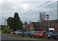
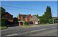
2
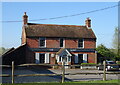
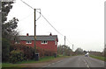
The Goat at Timsbury
On Stockbridge Road.
See Image] for sign.
Image: © JThomas
Taken: 26 Apr 2022
0.04 miles
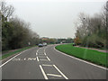
3
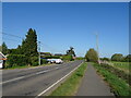
National Cycle Route 24, Timsbury
Beside the A3057.
Image: © JThomas
Taken: 26 Apr 2022
0.04 miles
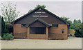
4
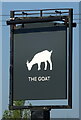
Sign for the Goat at Timsbury
See Image] for public house.
Image: © JThomas
Taken: 26 Apr 2022
0.04 miles
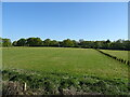
6
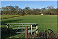
Field entrance beside the Stockbridge Road at Timsbury
Image: © David Martin
Taken: 15 Jan 2023
0.06 miles