IMAGES TAKEN NEAR TO
Tote Hill, ROMSEY, SO51 0JU
Introduction
This page details the photographs taken nearby to Tote Hill, SO51 0JU by members of the Geograph project.
The Geograph project started in 2005 with the aim of publishing, organising and preserving representative images for every square kilometre of Great Britain, Ireland and the Isle of Man.

There are currently over 7.5m images from over14,400 individuals and you can help contribute to the project by visiting https://www.geograph.org.uk
Image Map
Images are licensed for reuse under creativecommons.org/licenses/by-sa/2.0
Notes
- Clicking on the map will re-center to the selected point.
- The higher the marker number, the further away the image location is from the centre of the postcode.
Image Listing (30 Images Found)
Images are licensed for reuse under creativecommons.org/licenses/by-sa/2.0
Image
Details
Distance
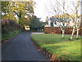
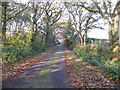
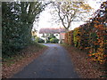
2
View past Merry Trees on Chapel Lane, Tote Hill
Image: © Nick Smith
Taken: 24 Nov 2010
0.02 miles
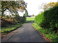
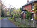
3
Driveway to Little Fosters on Chapel Lane, Tote Hill
Image: © Nick Smith
Taken: 24 Nov 2010
0.03 miles
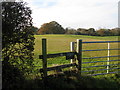
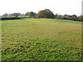
5
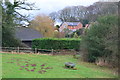
Corner of field on Chapel Lane
The moles have been busy here!
Image: © David Martin
Taken: 3 Feb 2018
0.05 miles