IMAGES TAKEN NEAR TO
Rose Close, EASTLEIGH, SO50 6JP
Introduction
This page details the photographs taken nearby to Rose Close, SO50 6JP by members of the Geograph project.
The Geograph project started in 2005 with the aim of publishing, organising and preserving representative images for every square kilometre of Great Britain, Ireland and the Isle of Man.

There are currently over 7.5m images from over14,400 individuals and you can help contribute to the project by visiting https://www.geograph.org.uk
Image Map
Images are licensed for reuse under creativecommons.org/licenses/by-sa/2.0
Notes
- Clicking on the map will re-center to the selected point.
- The higher the marker number, the further away the image location is from the centre of the postcode.
Image Listing (13 Images Found)
Images are licensed for reuse under creativecommons.org/licenses/by-sa/2.0
Image
Details
Distance
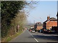
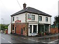
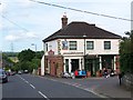
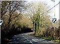
3
Church Road passes the Foresters Arms
Image: © Steve Daniels
Taken: 17 Mar 2016
0.07 miles
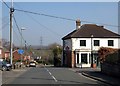
6
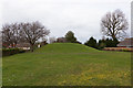
Grassy hillock on Burrow Hill
This area seems to be a small green.
Image: © Peter Facey
Taken: 4 Mar 2014
0.11 miles
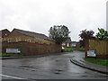
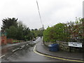
10
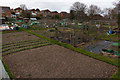
Allotments north of Jockey Lane
[elevated camera position]
Image: © Peter Facey
Taken: 4 Mar 2014
0.19 miles