IMAGES TAKEN NEAR TO
Upper Moors Road, EASTLEIGH, SO50 6HW
Introduction
This page details the photographs taken nearby to Upper Moors Road, SO50 6HW by members of the Geograph project.
The Geograph project started in 2005 with the aim of publishing, organising and preserving representative images for every square kilometre of Great Britain, Ireland and the Isle of Man.

There are currently over 7.5m images from over14,400 individuals and you can help contribute to the project by visiting https://www.geograph.org.uk
Image Map
Images are licensed for reuse under creativecommons.org/licenses/by-sa/2.0
Notes
- Clicking on the map will re-center to the selected point.
- The higher the marker number, the further away the image location is from the centre of the postcode.
Image Listing (36 Images Found)
Images are licensed for reuse under creativecommons.org/licenses/by-sa/2.0
Image
Details
Distance
1
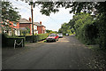
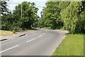
Upper Moors Road south of its junction with Tees Farm Road
One of the older parts of Colden Common, although not old enough to be shown on the 1940s OS map.
Image: © Peter Facey
Taken: 11 Jun 2006
0.05 miles
2
Tees Farm Road, Colden Common
Turning at right to Oak Tree Close. Pennington Close off picture left.
Image: © Peter Facey
Taken: 11 Jun 2006
0.08 miles
3
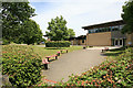
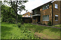
Primary School, Upper Moors Road, Colden Common
Image: © Peter Facey
Taken: 11 Jun 2006
0.10 miles
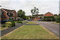
4
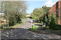
Tees Farm Road, Colden Common
Looking N from Church Lane.
Image: © Peter Facey
Taken: 1 Nov 2005
0.11 miles
5
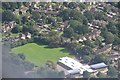
Winchester District : Colden Common Primary School
Looking down towards the primary school and grounds which serve Colden Common.
Image: © Lewis Clarke
Taken: 28 Aug 2012
0.13 miles
6
Junction of St Vigor Way and Upper Moors Road, Colden Common
Looking along St Vigor Way, with the Spar Shop at left, and beyond it the turning left to the Community Centre.
Image: © Peter Facey
Taken: 11 Jun 2006
0.14 miles
7
Grays Close, Colden Common
Looking along the stream which lies between the back of houses in Grays Close and Church Lane. Most of Grays Close is beyond and to the right of the more distant house shown here.
Image: © Peter Facey
Taken: 11 Jun 2006
0.15 miles
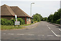
8
Church Lane junction with Bishopstoke Lane, Colden Common
Bishopstoke Lane on left. Bus stop on right, which is also the southern end of Upper Moors Road but only pedestrian access is provided there. Brambridge round corner in distance.
Image: © Peter Facey
Taken: 11 Jun 2006
0.16 miles