IMAGES TAKEN NEAR TO
The Mill Pond, SOUTHAMPTON, SO45 2QN
Introduction
This page details the photographs taken nearby to The Mill Pond, SO45 2QN by members of the Geograph project.
The Geograph project started in 2005 with the aim of publishing, organising and preserving representative images for every square kilometre of Great Britain, Ireland and the Isle of Man.

There are currently over 7.5m images from over14,400 individuals and you can help contribute to the project by visiting https://www.geograph.org.uk
Image Map
Images are licensed for reuse under creativecommons.org/licenses/by-sa/2.0
Notes
- Clicking on the map will re-center to the selected point.
- The higher the marker number, the further away the image location is from the centre of the postcode.
Image Listing (10 Images Found)
Images are licensed for reuse under creativecommons.org/licenses/by-sa/2.0
Image
Details
Distance
1
Footpath crossing The Mill Pond, Holbury
The road crossing from left to right gives access to a small housing development between the Mobile Home Park and the old quarry called The Mill Pond, after the nearby millpond.
Image: © Jim Champion
Taken: 4 Aug 2006
0.04 miles
2
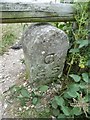
Old Boundary Marker in Holbury, Fawley parish
Boundary Marker in parish of Fawley (New Forest District), Holbury, West corner of grazing land, in front of gate.
Inscription reads:-
C.
S.S.
Surveyed
Milestone Society National ID: HA_HOLCSS03bm
Image: © Milestone Society
Taken: Unknown
0.11 miles
3
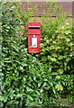
Elizabeth II postbox on Lime Kiln Lane, Hardley
Postbox No. SO45 711.
Image: © JThomas
Taken: 28 Apr 2022
0.12 miles
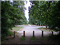
5
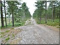
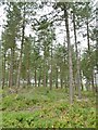
Dibden Inclosure, forestry road
Bumps in the road are caused by gullies dropping down to the bog, to the left.
Image: © Mike Faherty
Taken: 20 Jul 2015
0.19 miles
6
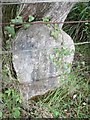
Old Boundary Marker near Holbury, Fawley parish
Boundary Marker in parish of Fawley (New Forest District), Holbury, Southwest corner by bog against fence.
Surveyed
Milestone Society National ID: HA_HOLCSS04bm
Image: © Milestone Society
Taken: Unknown
0.20 miles
7
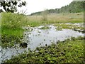
Hardley, bog
At the southern end of a bottom that feeds into Mill Pond and Dark Water.
Image: © Mike Faherty
Taken: 20 Jul 2015
0.20 miles
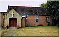
8
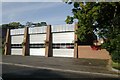
Hardley fire station
Hardley fire station, Falconer Court, Hardley, Hampshire covers the large oil refinery at Fawley on the banks of the Solent, as well as Hardley and the surrounding area.
Image: © Kevin Hale
Taken: 11 Nov 2006
0.23 miles
9
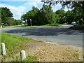
The Solent Way (129)
The Solent Way crosses a minor road close to the big roundabout at Hardley.
Image: © Shazz
Taken: 31 Aug 2012
0.25 miles