IMAGES TAKEN NEAR TO
Lower Pennington Lane, LYMINGTON, SO41 8ZZ
Introduction
This page details the photographs taken nearby to Lower Pennington Lane, SO41 8ZZ by members of the Geograph project.
The Geograph project started in 2005 with the aim of publishing, organising and preserving representative images for every square kilometre of Great Britain, Ireland and the Isle of Man.

There are currently over 7.5m images from over14,400 individuals and you can help contribute to the project by visiting https://www.geograph.org.uk
Image Map
Images are licensed for reuse under creativecommons.org/licenses/by-sa/2.0
Notes
- Clicking on the map will re-center to the selected point.
- The higher the marker number, the further away the image location is from the centre of the postcode.
Image Listing (8 Images Found)
Images are licensed for reuse under creativecommons.org/licenses/by-sa/2.0
Image
Details
Distance
2
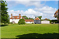
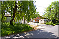
Farm House with Barn
This fine house has several outbuildings, including the barn sitting on staddle stones. These mushroom-shaped stones were used to lift barns and granaries off the ground, keeping the contents dry. For more staddle stones, see Image
Image: © mike smith
Taken: 25 May 2011
0.16 miles
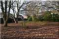
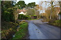
5
Sadlers Farm Entrance
Despite the proximity of urbanisation in Pennington, there are still several farms in the area.
Image: © mike smith
Taken: 25 May 2011
0.22 miles
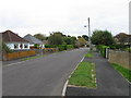
6
Lower Pennington Lane near Sadlers Farm
Image: © David Martin
Taken: 26 Dec 2016
0.22 miles
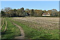
8
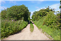
Footpath at Lower Pennington
Unlike some others in the immediate area, this path is wide and well surfaced.
Image: © mike smith
Taken: 25 May 2011
0.24 miles