
IMAGES TAKEN NEAR TO
Rumbridge Street, SOUTHAMPTON, SO40 9EA
Introduction
This page details the photographs taken nearby to Rumbridge Street, SO40 9EA by members of the Geograph project.
The Geograph project started in 2005 with the aim of publishing, organising and preserving representative images for every square kilometre of Great Britain, Ireland and the Isle of Man.

There are currently over 7.5m images from over14,400 individuals and you can help contribute to the project by visiting https://www.geograph.org.uk
Image Map
Images are licensed for reuse under creativecommons.org/licenses/by-sa/2.0
Notes
- Clicking on the map will re-center to the selected point.
- The higher the marker number, the further away the image location is from the centre of the postcode.
Image Listing (49 Images Found)
Images are licensed for reuse under creativecommons.org/licenses/by-sa/2.0
Image
Details
Distance
2
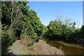
Path alongside Bartley Water, south Totton
Image: © Tim Heaton
Taken: 9 Oct 2023
0.04 miles
3
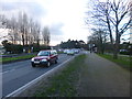
Totton By-pass
A35, avoiding Rumbridge Street and High Street.
Image: © Mike Faherty
Taken: 1 Mar 2014
0.05 miles
5
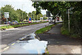
Totton bypass
Viewed from the Rushington roundabout bus stop.
Image: © John Lucas
Taken: 8 Sep 2022
0.07 miles
6
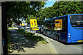
Totton snarl-up
Repairs to the road bridge at Redbridge have been ongoing since January and set to continue until July. As a result, this is a common sight on Totton by-pass.
Image: © John Lucas
Taken: 24 May 2023
0.07 miles
9
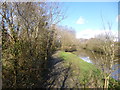
Totton, Bartley Water
Looking upstream; the river rises near Minstead, and joins River Teat at Eling.
Image: © Mike Faherty
Taken: 1 Mar 2014
0.10 miles
10
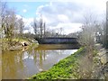
Totton, Rum Bridge
Carrying A35 (Totton By-pass) over Bartley Water. The river is high after prolonged rain.
Image: © Mike Faherty
Taken: 1 Mar 2014
0.10 miles