IMAGES TAKEN NEAR TO
Goldcrest Lane, SOUTHAMPTON, SO40 8UT
Introduction
This page details the photographs taken nearby to Goldcrest Lane, SO40 8UT by members of the Geograph project.
The Geograph project started in 2005 with the aim of publishing, organising and preserving representative images for every square kilometre of Great Britain, Ireland and the Isle of Man.

There are currently over 7.5m images from over14,400 individuals and you can help contribute to the project by visiting https://www.geograph.org.uk
Image Map (Loading...)


Getting Data...Please wait
Leaflet Map data © OpenStreetMap
Images are licensed for reuse under creativecommons.org/licenses/by-sa/2.0
Notes
- Clicking on the map will re-center to the selected point.
- The higher the marker number, the further away the image location is from the centre of the postcode.
Image Listing (11 Images Found)
Images are licensed for reuse under creativecommons.org/licenses/by-sa/2.0
Image
Details
Distance
1
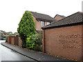
Every Generation Needs a New Revolution
Graffiti in Stonechat Drive. At the time, land near St Paul's Cathedral had recently been occupied by an anti-capitalist movement.
Image: © Burgess Von Thunen
Taken: 10 Nov 2011
0.06 miles
2
Clydesdale Way
1980s houses in Totton.
Image: © Burgess Von Thunen
Taken: 10 Nov 2011
0.07 miles
3
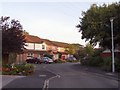
Lapwing Drive, Totton
Early morning sun on the houses of Lapwing Drive. All the roads and cul-de-sacs in this estate are named after British birds.
Image: © Jim Champion
Taken: 19 Sep 2006
0.08 miles
4
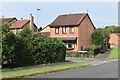
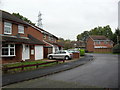
Modern housing in West Totton
The end of Shetland Close seen from Stonechat Drive.
Image: © David Martin
Taken: 4 Oct 2023
0.13 miles
5
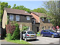
Nightingale Drive
1980s house in Totton.
Image: © Burgess Von Thunen
Taken: 10 Nov 2011
0.15 miles
6
Rufus Gardens
1990s flats in Totton.
Image: © Burgess Von Thunen
Taken: 22 May 2012
0.17 miles
7
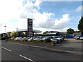
Calmore Service Station on Calmore Road
http://www.calmoreservicestation.co.uk/
Image: © Geographer
Taken: 27 Jun 2014
0.20 miles
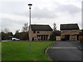
8
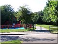
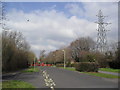
Cycle path and play area, Hazel Farm
This extensive area of housing is served by a network of paths, separating pedestrians and cyclists from vehicle traffic
Image: © David Martin
Taken: 13 Jun 2010
0.21 miles
9
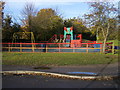
Hazel Farm North play area
Brightly coloured Hazel Farm North children's play area
Image: © Shaun Ferguson
Taken: 7 Nov 2008
0.23 miles
10
Hazel Farm Road
Outside Hazel Wood Infant School in Totton.
Image: © Burgess Von Thunen
Taken: 21 Mar 2012
0.24 miles