IMAGES TAKEN NEAR TO
Long Lane, SOUTHAMPTON, SO40 4WR

Introduction

This page details the photographs taken nearby to Long Lane, SO40 4WR by members of the Geograph project.

The Geograph project started in 2005 with the aim of publishing, organising and preserving representative images for every square kilometre of Great Britain, Ireland and the Isle of Man.

There are currently over 7.5m images from over14,400 individuals and you can help contribute to the project by visiting https://www.geograph.org.uk

Image Map


Images are licensed for reuse under creativecommons.org/licenses/by-sa/2.0
Notes
  • Clicking on the map will re-center to the selected point.
  • The higher the marker number, the further away the image location is from the centre of the postcode.

Image Listing (31 Images Found)

Images are licensed for reuse under creativecommons.org/licenses/by-sa/2.0
  • ...
Image
Details
Distance
1
Part of Long Lane, Marchwood
The lane turns ninety degrees to the right here. It marks the SW edge of the built up area of Marchwood.
Image: © Peter Facey Taken: 27 Sep 2008
0.06 miles
2
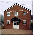
Marchwood Gospel Church
Image: © Michael FORD Taken: Unknown
0.06 miles
3
Housing on Lloyd Avenue, Marchwood
Seen from Long Lane. The white van is on Lloyd Avenue.
Image: © Peter Facey Taken: 27 Sep 2008
0.08 miles
4
Junction of Hythe Road and Long Lane, Marchwood
The Gospel Church is seen at left.
Image: © Peter Facey Taken: 27 Sep 2008
0.08 miles
5
View along railway towards Marchwood Station
This is the view from the level crossing on Tavell's Lane.
Image: © David Martin Taken: 14 May 2011
0.10 miles
6
Looking 'up' (towards Totton) from Marchwood level crossing
The spur branching to the right is a catch line ending in a sand trap, presumably to catch runaway oil trains in the days that they were running. There is also a catch point on the loop line.
Image: © John Lucas Taken: 4 Jul 2023
0.10 miles
7
Marchwood Railway Station
Marchwood Railway station looking to the level crossing on Main Road. The station closed in 1966 and the line is now freight only.
Image: © Shaun Ferguson Taken: 3 Oct 2010
0.12 miles
8
Level crossing gates on Main Road
Image: © JThomas Taken: 28 Apr 2022
0.12 miles
9
Level Crossing on Main Road, Marchwood
The line behind photographer is Image going to Marchwood Military Port. These gates were padlocked, so the line is presumably only used infrequently, although it also goes to Fawley oil refinery.
Image: © Peter Facey Taken: 27 Sep 2008
0.12 miles
10
Main road, Marchwood
Towards the Level Crossing.
Image: © John Lucas Taken: 4 Jul 2023
0.13 miles
  • ...