IMAGES TAKEN NEAR TO
Camilla Close, SOUTHAMPTON, SO40 2BH
Introduction
This page details the photographs taken nearby to Camilla Close, SO40 2BH by members of the Geograph project.
The Geograph project started in 2005 with the aim of publishing, organising and preserving representative images for every square kilometre of Great Britain, Ireland and the Isle of Man.

There are currently over 7.5m images from over14,400 individuals and you can help contribute to the project by visiting https://www.geograph.org.uk
Image Map
Images are licensed for reuse under creativecommons.org/licenses/by-sa/2.0
Notes
- Clicking on the map will re-center to the selected point.
- The higher the marker number, the further away the image location is from the centre of the postcode.
Image Listing (33 Images Found)
Images are licensed for reuse under creativecommons.org/licenses/by-sa/2.0
Image
Details
Distance
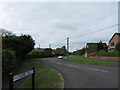
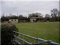
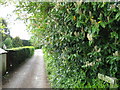
2
The old road to Tatchbury Mount now a dead end
This used to be the road to Tatchbury Mount before the A326 road cut it off, now at the end of the road is a footpath that leads you to the bridge that goes to Tatchbury mount. You can see where the road use to continue the other side of the A326 My uncle always told me of a big old oak that used to be alongside this lane in the 1930s when he lived at Woodlodge.
Image: © J W Parker
Taken: 2 Feb 2018
0.08 miles
3
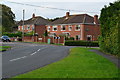
Houses on the corner of Loperwood Lane
Seen from Calmore Road.
Image: © David Martin
Taken: 15 Oct 2017
0.09 miles
6
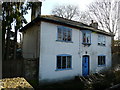
The old house alongside the drove that used to lead to Woodlodge
This house dates back to pre-1930s and is at the entrance to the drove which used to lead to a large 1920s house called Woodlodge; the house was taken down and the land was turned into Woodlodge Close.
Image: © J W Parker
Taken: 2 Feb 2018
0.11 miles
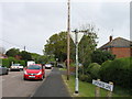
7
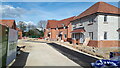
New housing development, Loperwood Lane
Image: © David Martin
Taken: 18 Apr 2022
0.12 miles
8
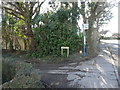
Entrance to the old road called the drove
Entrance to the drove that used to lead to Woodlodge house in the 1920's to at least the 1940's.
Image: © J W Parker
Taken: 2 Feb 2018
0.12 miles
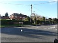
10
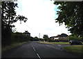
Calmore Road, Calmore
At the junction with Calmore Drive
Image: © Geographer
Taken: 27 Jun 2014
0.13 miles