IMAGES TAKEN NEAR TO
Bridge Road, SOUTHAMPTON, SO31 7FL
Introduction
This page details the photographs taken nearby to Bridge Road, SO31 7FL by members of the Geograph project.
The Geograph project started in 2005 with the aim of publishing, organising and preserving representative images for every square kilometre of Great Britain, Ireland and the Isle of Man.

There are currently over 7.5m images from over14,400 individuals and you can help contribute to the project by visiting https://www.geograph.org.uk
Image Map
Images are licensed for reuse under creativecommons.org/licenses/by-sa/2.0
Notes
- Clicking on the map will re-center to the selected point.
- The higher the marker number, the further away the image location is from the centre of the postcode.
Image Listing (30 Images Found)
Images are licensed for reuse under creativecommons.org/licenses/by-sa/2.0
Image
Details
Distance
1
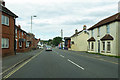
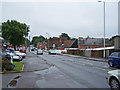
A27 Bridge Road, Lower Swanwick
Descending gently towards the River Hamble crossing.
Image: © Robin Webster
Taken: 16 Sep 2018
0.03 miles
5
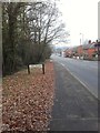
Bridge Road, Lower Swanwick
The area on the right is Swanwick Shore conservation area, which includes many listed buildings.
"Swanwick Shore occupies a bend on the eastern side of the River Hamble. The Conservation Area comprises the group of buildings, public hard and river frontage that form the village settlement at Lower Swanwick. The hard and river frontage is situated on low lying ground south of Bridge Road, close to the Bursledon Bridge". (Conservation Area Character Assessment - Fareham Borough Council - http://www.fareham.gov.uk/council/departments/planning/character/083-98Swanwick.pdf ).
Image: © Richard Dorrell
Taken: 1 Aug 2009
0.05 miles
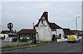
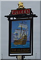
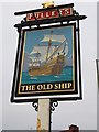
8
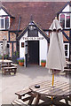
The Old Ship, Swanwick
The Old Ship on Bridge Road is a grade II listed Fullers pub dating from the 16th century. It has this pleasant patio area for sitting outside but, despite the spring sunshine, it was really too cold to take advantage.
Image: © Stephen McKay
Taken: 14 Apr 2019
0.06 miles
9
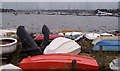
Swanwick Shore-River Hamble
I suspect that these rowing tenders don't need an anchor this size.
Image: © Colin Babb
Taken: 11 Nov 2005
0.08 miles
10
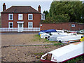
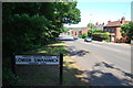
Public hard, Lower Swanwick
The road is Swanwick Shore Road. The house is Hard Cottage, which is dated 1760.
The gravel area is a public hard close to the shore of the River Hamble
Image: © Richard Dorrell
Taken: 1 Aug 2009
0.08 miles