Public hard, Lower Swanwick
Introduction
The photograph on this page of Public hard, Lower Swanwick by Richard Dorrell as part of the Geograph project.
The Geograph project started in 2005 with the aim of publishing, organising and preserving representative images for every square kilometre of Great Britain, Ireland and the Isle of Man.

There are currently over 7.5m images from over 14,400 individuals and you can help contribute to the project by visiting https://www.geograph.org.uk
Public hard, Lower Swanwick
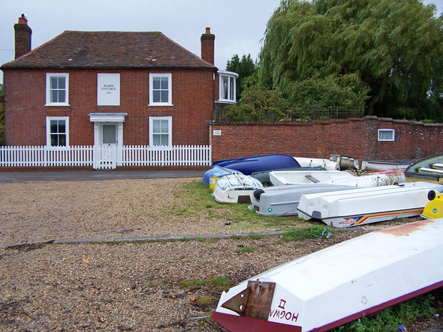
Image: © Richard Dorrell Taken: 1 Aug 2009
The road is Swanwick Shore Road. The house is Hard Cottage, which is dated 1760. The gravel area is a public hard close to the shore of the River Hamble
Images are licensed for reuse under creativecommons.org/licenses/by-sa/2.0
Image Location
Latitude
50.881076
Longitude
-1.29704