IMAGES TAKEN NEAR TO
Kootenay Avenue, SOUTHAMPTON, SO18 5RF
Introduction
This page details the photographs taken nearby to Kootenay Avenue, SO18 5RF by members of the Geograph project.
The Geograph project started in 2005 with the aim of publishing, organising and preserving representative images for every square kilometre of Great Britain, Ireland and the Isle of Man.

There are currently over 7.5m images from over14,400 individuals and you can help contribute to the project by visiting https://www.geograph.org.uk
Image Map
Images are licensed for reuse under creativecommons.org/licenses/by-sa/2.0
Notes
- Clicking on the map will re-center to the selected point.
- The higher the marker number, the further away the image location is from the centre of the postcode.
Image Listing (32 Images Found)
Images are licensed for reuse under creativecommons.org/licenses/by-sa/2.0
Image
Details
Distance
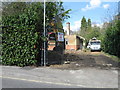
1
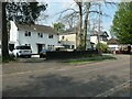
Houses on the west side of Kootenay Avenue
The street is named after a location in British Columbia, Canada.
Image: © Christine Johnstone
Taken: 23 Apr 2022
0.03 miles
2
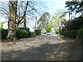
Kootenay Avenue, Southampton
On the north side of the A334. The road was laid out in the 1930s and the first few houses built before 1940.
Image: © Christine Johnstone
Taken: 23 Apr 2022
0.03 miles
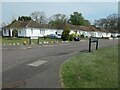
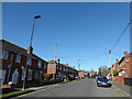
3
Bungalows, west side of Kootenay Avenue
The road was laid out in the 1930s, but these bungalows were built after 1945.
Image: © Christine Johnstone
Taken: 23 Apr 2022
0.05 miles
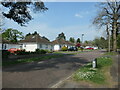
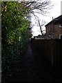
4
Moorhill Gardens, Southampton
On the east side of Kootenay Avenue.
Image: © Christine Johnstone
Taken: 23 Apr 2022
0.06 miles
6
![Thornhill Park Road [A334]](https://s1.geograph.org.uk/geophotos/07/17/58/7175833_5d7cc053_120x120.jpg)
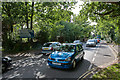
Thornhill Park Road [A334]
Looking westwards at the eastern edge of Southampton.
Image: © Christine Johnstone
Taken: 23 Apr 2022
0.08 miles
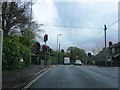
8
Footpath running in front of Moorhill Gardens
Many properties in Moorhill Gardens, are named with the word "View" in their house name.Unfortunately over the years large trees and laurel have grown in front of their homes, and their "View", now no longer exists!
Image: © dinglefoot
Taken: 18 Jan 2010
0.09 miles
9
2016: a year on Geograph (Day 42)
Top end of Hinkler Road
Image: © Basher Eyre
Taken: 11 Feb 2016
0.12 miles
10
A334 Thornhill Park Road
Entering the international maritime city of Southampton.
Image: © Peter Facey
Taken: 14 Jul 2009
0.13 miles