IMAGES TAKEN NEAR TO
Cobbett Road, SOUTHAMPTON, SO18 1HA
Introduction
This page details the photographs taken nearby to Cobbett Road, SO18 1HA by members of the Geograph project.
The Geograph project started in 2005 with the aim of publishing, organising and preserving representative images for every square kilometre of Great Britain, Ireland and the Isle of Man.

There are currently over 7.5m images from over14,400 individuals and you can help contribute to the project by visiting https://www.geograph.org.uk
Image Map (Loading...)


Getting Data...Please wait
Leaflet Map data © OpenStreetMap
Images are licensed for reuse under creativecommons.org/licenses/by-sa/2.0
Notes
- Clicking on the map will re-center to the selected point.
- The higher the marker number, the further away the image location is from the centre of the postcode.
Image Listing (42 Images Found)
Images are licensed for reuse under creativecommons.org/licenses/by-sa/2.0
Image
Details
Distance
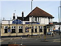
2
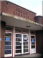
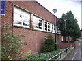
Bitterne Park Library
Beautifully 1930s.
Image: © Christopher Hilton
Taken: 11 Jan 2007
0.03 miles
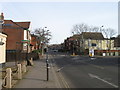
3
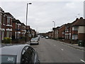
Bullar Road Southampton
Looking South
Image: © Alex McGregor
Taken: 22 Mar 2010
0.06 miles
4
Florist and Firework Factory after fire
Image: © Alex McGregor
Taken: 23 May 2016
0.08 miles
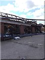
8
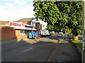
Solent Kitchen Design
Near Bittern station.
Image: © Hugh Venables
Taken: 26 May 2015
0.15 miles
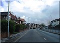
9
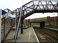
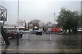
Looking through the bridge at Bitterne Station
The road bridge carries Bitterne Road West.
Image: © Shazz
Taken: 1 Mar 2013
0.16 miles