IMAGES TAKEN NEAR TO
Rampart Road, SOUTHAMPTON, SO18 1AG
Introduction
This page details the photographs taken nearby to Rampart Road, SO18 1AG by members of the Geograph project.
The Geograph project started in 2005 with the aim of publishing, organising and preserving representative images for every square kilometre of Great Britain, Ireland and the Isle of Man.

There are currently over 7.5m images from over14,400 individuals and you can help contribute to the project by visiting https://www.geograph.org.uk
Image Map (Loading...)


Getting Data...Please wait
Leaflet Map data © OpenStreetMap
Images are licensed for reuse under creativecommons.org/licenses/by-sa/2.0
Notes
- Clicking on the map will re-center to the selected point.
- The higher the marker number, the further away the image location is from the centre of the postcode.
Image Listing (81 Images Found)
Images are licensed for reuse under creativecommons.org/licenses/by-sa/2.0
Image
Details
Distance
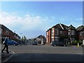
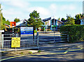
2
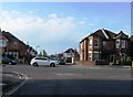
Rampart Road meets Bitterne Road West
Image: © Alex McGregor
Taken: 17 May 2013
0.04 miles
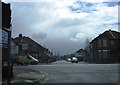
3
Rampart Road meets Bitterne Road West
Image: © Alex McGregor
Taken: 17 May 2013
0.04 miles
5
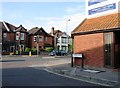
Rampart Road meets Bitterne Road West
Image: © Alex McGregor
Taken: 17 May 2013
0.05 miles
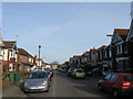
8
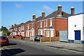
Houses on Quayside Road
Semi-detached houses alternating in the size of the pairs - larger with front doors and smaller with side doors.
Image: © Robin Webster
Taken: 2 Oct 2016
0.09 miles