1
Ivy Rd
Image: © N Chadwick
Taken: 3 Sep 2016
0.02 miles
2
North Road electricity substation, St Denys, Southampton
The SSE Power Distribution electricity substation is behind the long wooden fence.
Image: © Jaggery
Taken: 24 Aug 2016
0.03 miles
3
North Road, St Denys, Southampton
From Adelaide Road along North Road towards the Dundee Road junction. http://www.geograph.org.uk/photo/5088088
Image: © Jaggery
Taken: 24 Aug 2016
0.03 miles
4
View E from Adelaide Road level crossing, St Denys, Southampton
Image: © Gareth James
Taken: 15 Mar 2011
0.04 miles
5
South Road, St Denys, Southampton
From Adelaide Road along South Road towards Ivy Road.
Image: © Jaggery
Taken: 24 Aug 2016
0.05 miles
6
North Road
Image: © Oast House Archive
Taken: 29 Jun 2012
0.05 miles
7
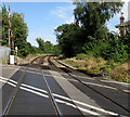
Railway across Adelaide Road, St Denys, Southampton
The level crossing is near St Denys station, 100 metres behind the camera.
Next station ahead is Woolston on the West Coastway Line towards Portsmouth.
The route was electrified (750 V DC third rail) by the Southern Railway during the interwar years.
The gap in the electrified third rails ends beyond the wooden planking.
Image: © Jaggery
Taken: 24 Aug 2016
0.06 miles
8
Adelaide Road level crossing, St Denys, Southampton
Image: © Gareth James
Taken: 15 Mar 2011
0.06 miles
9
St. Denys, level crossing
Carrying Southampton to Portsmouth railway lines across Adelaide Road.
Image: © Mike Faherty
Taken: 9 Dec 2016
0.06 miles
10
1881 house, Adelaide Road, St Denys, Southampton
The year 1881 is on the ornate circular inscription behind the low wall on the right.
A level crossing http://www.geograph.org.uk/photo/5092450 is on the left.
Image: © Jaggery
Taken: 24 Aug 2016
0.06 miles


