IMAGES TAKEN NEAR TO
Underwood Road, SOUTHAMPTON, SO16 7BU
Introduction
This page details the photographs taken nearby to Underwood Road, SO16 7BU by members of the Geograph project.
The Geograph project started in 2005 with the aim of publishing, organising and preserving representative images for every square kilometre of Great Britain, Ireland and the Isle of Man.

There are currently over 7.5m images from over14,400 individuals and you can help contribute to the project by visiting https://www.geograph.org.uk
Image Map
Images are licensed for reuse under creativecommons.org/licenses/by-sa/2.0
Notes
- Clicking on the map will re-center to the selected point.
- The higher the marker number, the further away the image location is from the centre of the postcode.
Image Listing (19 Images Found)
Images are licensed for reuse under creativecommons.org/licenses/by-sa/2.0
Image
Details
Distance
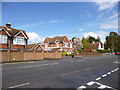
1
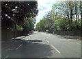
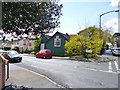
Winchester Road junction with Butterfield Road
Image: © Stuart Logan
Taken: 7 May 2012
0.10 miles
2
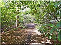
Bassett, path
Through woodland, from Winchester Road to Southampton Sports Centre.
Image: © Mike Faherty
Taken: 21 Apr 2012
0.11 miles
3
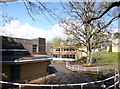
Bassett, Great Oaks School
In a beautiful setting in woodland off Winchester Road, a secondary school for pupils with learning difficulties. http://www.greatoaks.southampton.sch.uk/school/index.html
Image: © Mike Faherty
Taken: 21 Apr 2012
0.11 miles
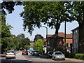
4
Bassett, Fair Havens
On Winchester Road; describing itself as a "Christian care home with nursing". http://www.housingcare.org/housing-care/facility-info-143633-fair-havens-christian-home-bassett-england.aspx
Image: © Mike Faherty
Taken: 21 Apr 2012
0.12 miles
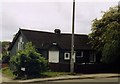
5
Bassett, tin chapel
On Winchester Road, at the corner of Pointout Road; easily overlooked. The building's name, "Verbum Dei" (The Word of God) gives a clue as to its former use; older OS maps show a mission room here.
Image: © Mike Faherty
Taken: 21 Apr 2012
0.14 miles
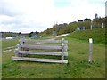
8
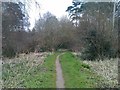
Path into woodland beside Thornhill Road
Image: © David Martin
Taken: 9 Mar 2013
0.16 miles
9
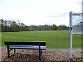
Southampton Sports Centre, cricket ground
One of two circular grounds at the centre: http://www.activenation.org.uk/outdoor-sports-centre.aspx
Image: © Mike Faherty
Taken: 21 Apr 2012
0.17 miles
10
Southampton Sports Centre, log stack
One of the obstacles in the fitness trail at http://www.activenation.org.uk/outdoor-sports-centre.aspx
Image: © Mike Faherty
Taken: 21 Apr 2012
0.18 miles