
IMAGES TAKEN NEAR TO
Winchester Road, SOUTHAMPTON, SO16 6TP
Introduction
This page details the photographs taken nearby to Winchester Road, SO16 6TP by members of the Geograph project.
The Geograph project started in 2005 with the aim of publishing, organising and preserving representative images for every square kilometre of Great Britain, Ireland and the Isle of Man.

There are currently over 7.5m images from over14,400 individuals and you can help contribute to the project by visiting https://www.geograph.org.uk
Image Map
Images are licensed for reuse under creativecommons.org/licenses/by-sa/2.0
Notes
- Clicking on the map will re-center to the selected point.
- The higher the marker number, the further away the image location is from the centre of the postcode.
Image Listing (134 Images Found)
Images are licensed for reuse under creativecommons.org/licenses/by-sa/2.0
Image
Details
Distance
1
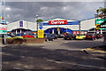
Shirley Park retail units, Winchester Road
These retail units on Winchester Road are part of 'Shirley Park', not to be confused with the original Shirley Park area of Southampton around Oakley Road.
Image: © Jim Champion
Taken: 8 May 2009
0.02 miles
2
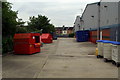
Rear of Shirley Park units
View along the back of the Shirley Park units (Pets at Home, Currys and a gym) from the back of Halfords. The houses in the middle of the photo are at the top of Queens Road.
Image: © Jim Champion
Taken: 12 May 2009
0.03 miles
3
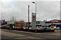
Shirley Retail Park, Southampton
Viewed across the A35 Winchester Road in the Upper Shirley area of Southampton.
In view are Currys, LA Fitness, Halfords and Wickes.
Image: © Jaggery
Taken: 16 Nov 2013
0.03 miles
4
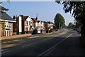
Winchester Road, Upper Shirley
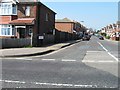
Looking north-east along Winchester Road; the turning on the left is Vincent Avenue. On the far left are new flats built on a redeveloped plot of land.
Image: © Jim Champion
Taken: 28 Sep 2008
0.04 miles
5
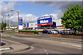
Wickes, Winchester Road
This Wickes store is on Winchester Road, moved here from Portswood Road a few years ago. The previous shop on this site was the department store Allders which ceased trading in 2005.
Image: © Jim Champion
Taken: 8 May 2009
0.04 miles
7
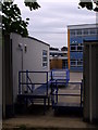
Upper Shirley High School
The back of Upper Shirley High School, from the rear of Halfords. The temporary classrooms are a relatively recent addition to the school.
Image: © Jim Champion
Taken: 12 May 2009
0.05 miles
8
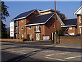
New flats, Winchester Road
These new flats have been built on a former industrial site to the east of The Range store on Winchester Road.
Image: © Jim Champion
Taken: 28 Sep 2008
0.06 miles
9
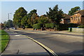
Winchester Road, Shirley
This part of Winchester Road is in front of the Wickes store (off to the left).
Image: © Jim Champion
Taken: 28 Sep 2008
0.06 miles
10

Shell Filling Station, Winchester Road
Image: © Alex McGregor
Taken: 9 Apr 2015
0.06 miles