IMAGES TAKEN NEAR TO
Seymour Road, SOUTHAMPTON, SO16 6RG
Introduction
This page details the photographs taken nearby to Seymour Road, SO16 6RG by members of the Geograph project.
The Geograph project started in 2005 with the aim of publishing, organising and preserving representative images for every square kilometre of Great Britain, Ireland and the Isle of Man.

There are currently over 7.5m images from over14,400 individuals and you can help contribute to the project by visiting https://www.geograph.org.uk
Image Map
Images are licensed for reuse under creativecommons.org/licenses/by-sa/2.0
Notes
- Clicking on the map will re-center to the selected point.
- The higher the marker number, the further away the image location is from the centre of the postcode.
Image Listing (111 Images Found)
Images are licensed for reuse under creativecommons.org/licenses/by-sa/2.0
Image
Details
Distance
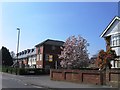
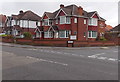
1
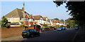
Seymour Road, Upper Shirley
View north-west along Seymour Road, from close to the junction with Winchester Road.
Image: © Jim Champion
Taken: 28 Sep 2008
0.03 miles
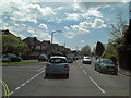
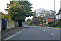
2
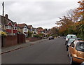
Seymour Road, Upper Shirley, Southampton
Viewed from the A35 Winchester Road. There are houses on only one side of the road in this part of Seymour Road.
Image: © Jaggery
Taken: 16 Nov 2013
0.06 miles
3
Malwood Avenue, Upper Shirley
The southern end of Malwood Avenue from the corner in Seymour Road.
Image: © Jim Champion
Taken: 28 Sep 2008
0.07 miles
4
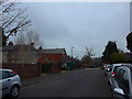
Looking north-northeast up Seagarth Lane
Image: © Basher Eyre
Taken: 4 Dec 2014
0.08 miles
6
Winchester Road junction with Burgess Road
Image: © Stuart Logan
Taken: 7 May 2012
0.08 miles
7
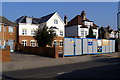
New flats, Winchester Road
These new flats are on the site of a demolished detached house, on the north side of Winchester Road.
Image: © Jim Champion
Taken: 28 Sep 2008
0.08 miles
8
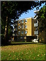
Flats, Seymour Close
A small block of flats on the corner of Seymour Road and Malwood Avenue.
Image: © Jim Champion
Taken: 28 Sep 2008
0.09 miles
9
AECC Chiropractic Clinic, Southampton
On the corner of Winchester Road and Luccombe Road, opposite Isaac Watts Memorial Church. http://www.geograph.org.uk/photo/3785829
The clinic is dedicated to treating patients in pain or discomfort, whether from an injury or a more chronic condition.
Image: © Jaggery
Taken: 16 Nov 2013
0.09 miles
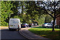
10
A35 Winchester Road, Southampton
Heading west.
Image: © Robin Webster
Taken: 13 Nov 2022
0.09 miles