IMAGES TAKEN NEAR TO
Burgess Road, SOUTHAMPTON, SO16 3TS
Introduction
This page details the photographs taken nearby to Burgess Road, SO16 3TS by members of the Geograph project.
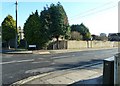
The Geograph project started in 2005 with the aim of publishing, organising and preserving representative images for every square kilometre of Great Britain, Ireland and the Isle of Man.

There are currently over 7.5m images from over14,400 individuals and you can help contribute to the project by visiting https://www.geograph.org.uk
Image Map
Images are licensed for reuse under creativecommons.org/licenses/by-sa/2.0
Notes
- Clicking on the map will re-center to the selected point.
- The higher the marker number, the further away the image location is from the centre of the postcode.
Image Listing (101 Images Found)
Images are licensed for reuse under creativecommons.org/licenses/by-sa/2.0
Image
Details
Distance
2
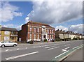
Highfield, library
Burgess Road Library: http://www.southampton.gov.uk/s-leisure/libraries/local-libraries/burgessroadlibrary.aspx
Image: © Mike Faherty
Taken: 21 Apr 2012
0.02 miles
3
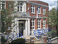
Burgess Road Library, Highfield, Southampton
Seen from the upper deck of a bus. For the context, see Mike Faherty's Image
Image: © Robin Stott
Taken: 25 Jun 2014
0.02 miles
4
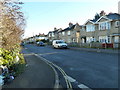
Approaching the junction of Iris and Honeysuckle Roads
Image: © Basher Eyre
Taken: 9 Jan 2011
0.03 miles
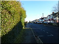
9
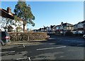
Looking from Begonia Road into Honeysuckle Road
Image: © Basher Eyre
Taken: 9 Jan 2011
0.05 miles