IMAGES TAKEN NEAR TO
Marshall Square, SOUTHAMPTON, SO15 2PQ
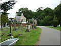
Introduction
This page details the photographs taken nearby to Marshall Square, SO15 2PQ by members of the Geograph project.
The Geograph project started in 2005 with the aim of publishing, organising and preserving representative images for every square kilometre of Great Britain, Ireland and the Isle of Man.

There are currently over 7.5m images from over14,400 individuals and you can help contribute to the project by visiting https://www.geograph.org.uk
Image Map
Images are licensed for reuse under creativecommons.org/licenses/by-sa/2.0
Notes
- Clicking on the map will re-center to the selected point.
- The higher the marker number, the further away the image location is from the centre of the postcode.
Image Listing (151 Images Found)
Images are licensed for reuse under creativecommons.org/licenses/by-sa/2.0
Image
Details
Distance
1
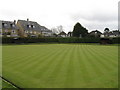
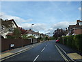
Bowling Green, Northlands Road, Southampton
With new housing edging ever closer
Image: © Alex McGregor
Taken: 3 Apr 2010
0.06 miles
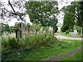
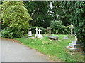
2
Road running parallel to a path in Cemetery Road
Image: © Basher Eyre
Taken: 19 Sep 2010
0.08 miles
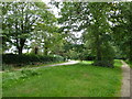
3
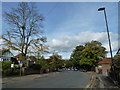
An autumnal anti-clockwise stroll (25)
Looking along Northlands Road towards the old County Cricket Ground.
Image: © Basher Eyre
Taken: 30 Oct 2012
0.09 miles
5
Looking from Westrow Road into Westrow Gardens
Image: © Basher Eyre
Taken: 30 Oct 2012
0.09 miles
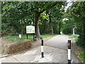
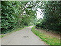
8
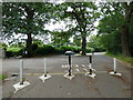
Pedestrianised part of Cemetery Road merges with the vehicular access
Image: © Basher Eyre
Taken: 19 Sep 2010
0.09 miles