IMAGES TAKEN NEAR TO
Cedar Road, SOUTHAMPTON, SO14 6HJ

Introduction

This page details the photographs taken nearby to Cedar Road, SO14 6HJ by members of the Geograph project.

The Geograph project started in 2005 with the aim of publishing, organising and preserving representative images for every square kilometre of Great Britain, Ireland and the Isle of Man.

There are currently over 7.5m images from over14,400 individuals and you can help contribute to the project by visiting https://www.geograph.org.uk

Image Map


Images are licensed for reuse under creativecommons.org/licenses/by-sa/2.0
Notes
  • Clicking on the map will re-center to the selected point.
  • The higher the marker number, the further away the image location is from the centre of the postcode.

Image Listing (74 Images Found)

Images are licensed for reuse under creativecommons.org/licenses/by-sa/2.0
  • ...
Image
Details
Distance
1
Earls Road
A narrow residential street where parking is limited. Sometimes you will see the road name with an apostrophe, but often not.
Image: © Bill Boaden Taken: 29 Sep 2016
0.07 miles
2
The Guide Dog
Image: © Alex McGregor Taken: 7 Feb 2014
0.08 miles
3
The Guide Dog
An excellent pub worth going out of your way for if you like beer. Ancasta Road runs alongside, and is named after a Celtic goddess with only one mention: https://en.wikipedia.org/wiki/Ancasta
Image: © Bill Boaden Taken: 29 Sep 2016
0.08 miles
4
Bevois Town, The Guide Dog
2010 Good Beer Guide-listed community pub with a friendly welcome, at the corner of Earls and Ancasta Roads. Internally, L-shaped bar to right, drinking area to left. Seven cask ales on offer at my visit. For some customer comments, see http://www.beerintheevening.com/pubs/s/20/20687/Guide_Dog/Bevois_Valley
Image: © Mike Faherty Taken: 17 Jul 2010
0.08 miles
5
The Guide Dog, Southampton
Pub on Ancasta Road.
Image: © Oast House Archive Taken: 30 Jun 2012
0.09 miles
6
Bevois Town, Earls Road
Victorian terraces.
Image: © Mike Faherty Taken: 17 Jul 2010
0.09 miles
7
The Lime Bar
Image: © Alex McGregor Taken: 7 Feb 2014
0.10 miles
8
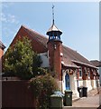
Bevois Town Church
Now used as a Community Centre.
Image: © Michael FORD Taken: Unknown
0.10 miles
9
Bevois Town Synagogue
Erected in 1963.
Image: © Michael FORD Taken: Unknown
0.11 miles
10
Bevois Town Church
At the corner of Clausentum and Ancasta Roads. http://www.facebook.com/group.php?gid=2375299845
Image: © Mike Faherty Taken: 17 Jul 2010
0.11 miles
  • ...