IMAGES TAKEN NEAR TO
Southcliff Road, SOUTHAMPTON, SO14 6FJ
Introduction
This page details the photographs taken nearby to Southcliff Road, SO14 6FJ by members of the Geograph project.
The Geograph project started in 2005 with the aim of publishing, organising and preserving representative images for every square kilometre of Great Britain, Ireland and the Isle of Man.

There are currently over 7.5m images from over14,400 individuals and you can help contribute to the project by visiting https://www.geograph.org.uk
Image Map
Images are licensed for reuse under creativecommons.org/licenses/by-sa/2.0
Notes
- Clicking on the map will re-center to the selected point.
- The higher the marker number, the further away the image location is from the centre of the postcode.
Image Listing (148 Images Found)
Images are licensed for reuse under creativecommons.org/licenses/by-sa/2.0
Image
Details
Distance
1
Southcliff Road, Southampton
Pedestrianised section
Image: © Alex McGregor
Taken: 3 Apr 2010
0.03 miles
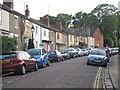
2
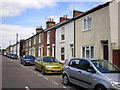
Victorian housing, Methuen Street, Southampton
Traditional Victorian terraced housing in Methuen Street, behind the Inner Avenue.
Image: © GaryReggae
Taken: 21 Jul 2008
0.03 miles
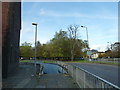
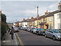
4
Middle Street, Southampton
Viewed from The Avenue
Image: © Alex McGregor
Taken: 3 Apr 2010
0.04 miles
5
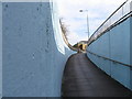
Subway ramp Dorset Street, Southampton
Image: © Alex McGregor
Taken: 3 Apr 2010
0.08 miles
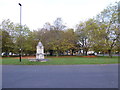
6
An autumnal anti-clockwise stroll (8)
Underpass approaching Asylum Green
Image: © Basher Eyre
Taken: 30 Oct 2012
0.09 miles
7
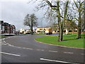
The Avenue, Southampton
Bottom of the Avenue where it meets London Road
Image: © Alex McGregor
Taken: 3 Apr 2010
0.09 miles
8
An autumnal anti-clockwise stroll (10)
Looking towards Asylum Green
Image: © Basher Eyre
Taken: 30 Oct 2012
0.09 miles
10
Rockstone Lane
Note the American highway patrol car, promotional car for the Rockstone pub at the start of the dead end residential road.
Image: © Oast House Archive
Taken: 29 Jun 2012
0.09 miles