IMAGES TAKEN NEAR TO
Orchard Lane, SOUTHAMPTON, SO14 3DD
Introduction
This page details the photographs taken nearby to Orchard Lane, SO14 3DD by members of the Geograph project.
The Geograph project started in 2005 with the aim of publishing, organising and preserving representative images for every square kilometre of Great Britain, Ireland and the Isle of Man.

There are currently over 7.5m images from over14,400 individuals and you can help contribute to the project by visiting https://www.geograph.org.uk
Image Map
Images are licensed for reuse under creativecommons.org/licenses/by-sa/2.0
Notes
- Clicking on the map will re-center to the selected point.
- The higher the marker number, the further away the image location is from the centre of the postcode.
Image Listing (624 Images Found)
Images are licensed for reuse under creativecommons.org/licenses/by-sa/2.0
Image
Details
Distance
2
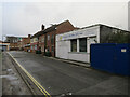
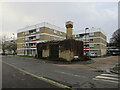
Crossroads of Eastgate Street, Canal Walk and Back of the Walls
Image: © Basher Eyre
Taken: 22 Feb 2011
0.01 miles
3
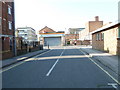
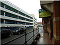
Looking along Lime Street towards Orchard Lane
Image: © Basher Eyre
Taken: 4 Mar 2011
0.01 miles
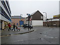
4
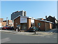
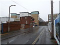
Corporate Clothing Solutions, Lime Street
Image: © Hugh Venables
Taken: 16 Jan 2018
0.03 miles
6
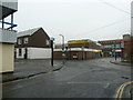
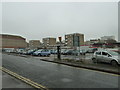
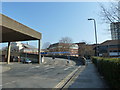
Multi storey car park between Bernard Street and East Street
Image: © Basher Eyre
Taken: 22 Feb 2011
0.04 miles
10
Looking from Back of the Walls into Eastgate Street
Image: © Basher Eyre
Taken: 22 Feb 2011
0.05 miles