IMAGES TAKEN NEAR TO
Queens Way, SOUTHAMPTON, SO14 1NH
Introduction
This page details the photographs taken nearby to Queens Way, SO14 1NH by members of the Geograph project.
The Geograph project started in 2005 with the aim of publishing, organising and preserving representative images for every square kilometre of Great Britain, Ireland and the Isle of Man.

There are currently over 7.5m images from over14,400 individuals and you can help contribute to the project by visiting https://www.geograph.org.uk
Image Map
Images are licensed for reuse under creativecommons.org/licenses/by-sa/2.0
Notes
- Clicking on the map will re-center to the selected point.
- The higher the marker number, the further away the image location is from the centre of the postcode.
Image Listing (766 Images Found)
Images are licensed for reuse under creativecommons.org/licenses/by-sa/2.0
Image
Details
Distance
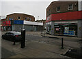
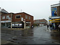
1
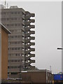
Block of flats, staircase, north of East Street Centre
Image: © Alexander P Kapp
Taken: 14 May 2009
0.02 miles
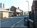
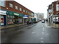
2
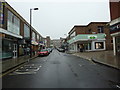
Approaching the junction of East Street and York Buildings
Image: © Basher Eyre
Taken: 22 Feb 2011
0.03 miles
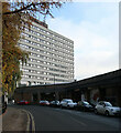
6
Approaching a chippy in Lime Street
Sam's Plaice- get it!
Image: © Basher Eyre
Taken: 4 Mar 2011
0.03 miles
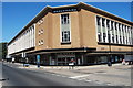
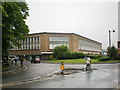
8
Houndwell Place, Southampton
The back of Debenhams and Capital House.
Image: © Hugh Venables
Taken: 14 Nov 2019
0.04 miles
9
Junction of Back of the Walls and East Street
Image: © Basher Eyre
Taken: 22 Feb 2011
0.04 miles
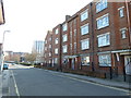
10
Looking from Back of the Walls into East Street
Image: © Basher Eyre
Taken: 22 Feb 2011
0.04 miles