IMAGES TAKEN NEAR TO
St. Marys Road, SOUTHAMPTON, SO14 0AH
Introduction
This page details the photographs taken nearby to St. Marys Road, SO14 0AH by members of the Geograph project.
The Geograph project started in 2005 with the aim of publishing, organising and preserving representative images for every square kilometre of Great Britain, Ireland and the Isle of Man.

There are currently over 7.5m images from over14,400 individuals and you can help contribute to the project by visiting https://www.geograph.org.uk
Image Map
Images are licensed for reuse under creativecommons.org/licenses/by-sa/2.0
Notes
- Clicking on the map will re-center to the selected point.
- The higher the marker number, the further away the image location is from the centre of the postcode.
Image Listing (218 Images Found)
Images are licensed for reuse under creativecommons.org/licenses/by-sa/2.0
Image
Details
Distance
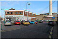
5

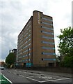
Block A, Orion's Point, Dorset Street
See also Image
Image: © Peter Facey
Taken: 17 Jan 2010
0.06 miles
6
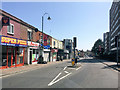
Onslow Road, Southampton
The small cul de sac at right is named Fanshawe Street.
Image: © Peter Facey
Taken: 19 Dec 2007
0.06 miles
7
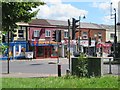
Southampton, Unity 101
Community radio station on St Mary's Road. http://www.unity101.org/
Image: © Mike Faherty
Taken: 17 Jul 2010
0.06 miles
8
An autumnal anti-clockwise stroll (4)
Looking across Dorset Street
Image: © Basher Eyre
Taken: 30 Oct 2012
0.06 miles
9
An autumnal anti-clockwise stroll (6)
Houses in Dorset Street
Image: © Basher Eyre
Taken: 30 Oct 2012
0.07 miles
10
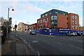
Silverlake Automotive Recycling
By Royal South Hants Hospital.
Image: © Hugh Venables
Taken: 14 Nov 2019
0.07 miles