
IMAGES TAKEN NEAR TO
Wilsford, PEWSEY, SN9 6HB
Introduction
This page details the photographs taken nearby to SN9 6HB by members of the Geograph project.
The Geograph project started in 2005 with the aim of publishing, organising and preserving representative images for every square kilometre of Great Britain, Ireland and the Isle of Man.

There are currently over 7.5m images from over14,400 individuals and you can help contribute to the project by visiting https://www.geograph.org.uk
Image Map
Images are licensed for reuse under creativecommons.org/licenses/by-sa/2.0
Notes
- Clicking on the map will re-center to the selected point.
- The higher the marker number, the further away the image location is from the centre of the postcode.
Image Listing (84 Images Found)
Images are licensed for reuse under creativecommons.org/licenses/by-sa/2.0
Image
Details
Distance
1
![Wilsford thatch [6]](https://s2.geograph.org.uk/geophotos/05/26/10/5261078_03f9f881_120x120.jpg)
Wilsford thatch [6]
Number 19 The Street.
Image: © Michael Dibb
Taken: 21 Jan 2017
0.01 miles
2
![Wilsford thatch [5]](https://s3.geograph.org.uk/geophotos/05/26/10/5261075_9474477c_120x120.jpg)
Wilsford thatch [5]
There is no way in through this door to Yew Tree Farmhouse. This early 19th century property is in very poor condition. Listed, grade II, with details at: https://www.historicengland.org.uk/listing/the-list/list-entry/1320126
Image: © Michael Dibb
Taken: 21 Jan 2017
0.03 miles
3
![Wilsford thatch [7]](https://s0.geograph.org.uk/geophotos/05/26/10/5261080_26b6a77b_120x120.jpg)
Wilsford thatch [7]
This lovely cottage at number 18 is 15th century or possibly earlier. The structure has four pairs of full crucks. Listed, grade II, with details at: https://www.historicengland.org.uk/listing/the-list/list-entry/1365581
Image: © Michael Dibb
Taken: 21 Jan 2017
0.04 miles
4
![Wilsford thatch [8]](https://s2.geograph.org.uk/geophotos/05/26/10/5261082_52f0a769_120x120.jpg)
Wilsford thatch [8]
This 17th century house is now two dwellings. Listed, grade II, with details at:
https://www.historicengland.org.uk/listing/the-list/list-entry/1116066
Image: © Michael Dibb
Taken: 21 Jan 2017
0.06 miles
5
![Wilsford thatch [9]](https://s0.geograph.org.uk/geophotos/05/26/10/5261088_f8f5ded6_120x120.jpg)
Wilsford thatch [9]
This property is listed as two cottages in a row, one 17th century and one 19th century. They were converted to a single dwelling in 2006. Listed, grade II, with details at: https://www.historicengland.org.uk/listing/the-list/list-entry/1116072
Image: © Michael Dibb
Taken: 21 Jan 2017
0.06 miles
6
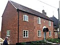
Number 13 The Street
This 1819 house is somewhat spoit by the 20th century addition of the third bay. Listed, grade II, with details at: https://www.historicengland.org.uk/listing/the-list/list-entry/1033907
Image: © Michael Dibb
Taken: 5 Jun 2018
0.06 miles
7
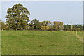
Footpath across field north of Wilsford
Image: © David Martin
Taken: 19 Oct 2020
0.07 miles
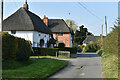
9
![Wilsford thatch [13]](https://s1.geograph.org.uk/geophotos/05/81/66/5816621_5afc045b_120x120.jpg)
Wilsford thatch [13]
This attractive 18th century cottage has a timber-framed upper floor. Listed, grade II, with details at: https://www.historicengland.org.uk/listing/the-list/list-entry/1033909
Image: © Michael Dibb
Taken: 5 Jun 2018
0.11 miles
10

Thatched walls
There is over 100 metres of thatched wall around the garden of The Old Vicarage. Listed, grade II, with details at: https://www.historicengland.org.uk/listing/the-list/list-entry/1033908
Image: © Michael Dibb
Taken: 5 Jun 2018
0.11 miles