
IMAGES TAKEN NEAR TO
Upavon, PEWSEY, SN9 6BG
Introduction
This page details the photographs taken nearby to SN9 6BG by members of the Geograph project.
The Geograph project started in 2005 with the aim of publishing, organising and preserving representative images for every square kilometre of Great Britain, Ireland and the Isle of Man.

There are currently over 7.5m images from over14,400 individuals and you can help contribute to the project by visiting https://www.geograph.org.uk
Image Map
Images are licensed for reuse under creativecommons.org/licenses/by-sa/2.0
Notes
- Clicking on the map will re-center to the selected point.
- The higher the marker number, the further away the image location is from the centre of the postcode.
Image Listing (5 Images Found)
Images are licensed for reuse under creativecommons.org/licenses/by-sa/2.0
Image
Details
Distance
1
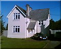
No 1 AMQ Upavon
One of the original buildings of 'RAF Upavon' indicated by 1914 above the bedroom window.
Image: © bj kerr
Taken: 2 Sep 2005
0.10 miles
2
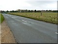
Military buildings and the road to Netheravon
Viewed facing west north west. The buildings towards the right are in this square. The ones towards the left are in SU1555. The southern gridline is about 30 metres south of the viewpoint.
Image: © Brian Robert Marshall
Taken: 2 Mar 2008
0.13 miles
5
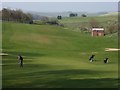
Upavon Golf Club
Beautifully set in a downland valley. This is the view from the third tee, which is in the northeast corner of the course, across the second green and fairway.
Image: © Andrew Smith
Taken: 8 Apr 2007
0.25 miles