
IMAGES TAKEN NEAR TO
Green Drove, PEWSEY, SN9 5JE
Introduction
This page details the photographs taken nearby to Green Drove, SN9 5JE by members of the Geograph project.
The Geograph project started in 2005 with the aim of publishing, organising and preserving representative images for every square kilometre of Great Britain, Ireland and the Isle of Man.

There are currently over 7.5m images from over14,400 individuals and you can help contribute to the project by visiting https://www.geograph.org.uk
Image Map
Images are licensed for reuse under creativecommons.org/licenses/by-sa/2.0
Notes
- Clicking on the map will re-center to the selected point.
- The higher the marker number, the further away the image location is from the centre of the postcode.
Image Listing (16 Images Found)
Images are licensed for reuse under creativecommons.org/licenses/by-sa/2.0
Image
Details
Distance
1

Bridleway, Southcott
The bridleway known as Green Drove takes walkers and riders towards the Pewsey White Horse and Pewsey Hill.
Image: © Maigheach-gheal
Taken: 6 Jun 2010
0.04 miles
2
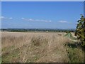
The Vale of Pewsey
Seen from Winter's Drove is this view of the Vale of Pewsey. Green Drove Farm is seen near the base of the electricity pylon and in the far distance is Draycott Hill with Gopher Wood prominent.
Image: © Michael Dibb
Taken: 5 Sep 2018
0.08 miles
3
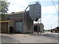
Green Drove Farm
The farm is seen from the drove.
Image: © Michael Dibb
Taken: 5 Sep 2018
0.10 miles
4
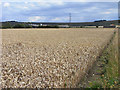
Farmland, Pewsey
A wheat crop to the south of Swan Meadow. Looking towards Green Drove Farm and the scarp of Pewsey Hill.
Image: © Andrew Smith
Taken: 25 Jul 2009
0.10 miles
5
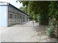
Path leaves the drove
The footpath leaves Green Drove and runs a short distance to Swan Meadow. The building is part of Green Drove Farm.
Image: © Michael Dibb
Taken: 5 Sep 2018
0.11 miles
6
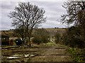
Track past Green Drove Farm buildings
This path is known as Green Drove and is to the South of Pewsey. Here it is passing some outlying farm buildings which belong to Green Drove Farm.
The path leads to the Pewsey White Horse that can just be made out on Pewsey Hill in the centre of the picture.
The farm buildings house large machinery and the land either side of the path is cultivated.
It is one of 3 parallel tracks all of which are popular walks with the local people of Pewsey.
Image: © Gillie Rhodes
Taken: 1 Mar 2013
0.17 miles
7
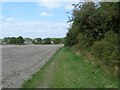
Towards Swan Meadow
The footpath from Green Drove to Swan Meadow follows the field edge.
Image: © Michael Dibb
Taken: 5 Sep 2018
0.17 miles
8
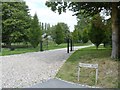
The drive to the manor
The entrance driveway to Southcott Manor. There are some fine sculptures to the left of the driveway.
Image: © Michael Dibb
Taken: 5 Sep 2018
0.20 miles
9
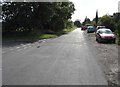
SE along Green Drove near Pewsey
Out of shot ahead, Green Drove leads to Southcott Road and Ball Road,
a circuitous route to the eastern end of High Street Pewsey.
The Swan Meadow junction https://www.geograph.org.uk/photo/6237184 is on the left.
Image: © Jaggery
Taken: 15 Sep 2018
0.21 miles
10
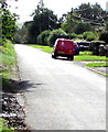
Red Royal Mail van, Green Drove near Pewsey
Parked while its driver delivers letters and small parcels to nearby houses.
Image: © Jaggery
Taken: 15 Sep 2018
0.22 miles