
IMAGES TAKEN NEAR TO
Froxfield, MARLBOROUGH, SN8 3HU
Introduction
This page details the photographs taken nearby to SN8 3HU by members of the Geograph project.
The Geograph project started in 2005 with the aim of publishing, organising and preserving representative images for every square kilometre of Great Britain, Ireland and the Isle of Man.

There are currently over 7.5m images from over14,400 individuals and you can help contribute to the project by visiting https://www.geograph.org.uk
Image Map
Images are licensed for reuse under creativecommons.org/licenses/by-sa/2.0
Notes
- Clicking on the map will re-center to the selected point.
- The higher the marker number, the further away the image location is from the centre of the postcode.
Image Listing (26 Images Found)
Images are licensed for reuse under creativecommons.org/licenses/by-sa/2.0
Image
Details
Distance
1
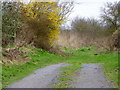
Bridleway near Harrow Farm
The bridleway takes walkers and riders towards Rudge Farm House.
Image: © Maigheach-gheal
Taken: 5 Mar 2011
0.05 miles
2
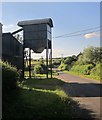
Farm building, Harrow Farm
By the road to Rudge, and seen from the same place as Image Official nomenclature gratefully received.
Image: © Derek Harper
Taken: 21 Jun 2014
0.05 miles
3
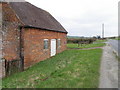
Buildings, Harrow Farm
Set into the wall of this brick building is a Victorian reign postbox. For a close-up of the postbox Image
Image: © Maigheach-gheal
Taken: 5 Mar 2011
0.06 miles
4
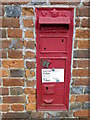
Postbox, Harrow Farm
The Victorian reign postbox is set into the wall of an outbuilding at Harrow Farm.
Image: © Maigheach-gheal
Taken: 5 Mar 2011
0.06 miles
7
At Harrow Farm
A short distance ahead the lane I'm standing by crosses the A4 - the old Bath Road - before continuing uphill towards Chisbury and Little Bedwyn.
Many of the lanes in this area ramble from village to village, or from farm to village, and must date from times when village folk seldom strayed far from home. The resulting network plainly wasn't designed for the convenience of through traffic. Major roads - even one as ancient as the Bath Road - seem to slice through, connecting with the old network at relatively few points.
Image: © Stefan Czapski
Taken: 6 Jun 2019
0.08 miles
8
Harrow Farm Cottage
A thatched cottage beside a crossroads on the A4. The lane ahead is for Chisbury.
Image: © Derek Harper
Taken: 21 Jun 2014
0.08 miles
9
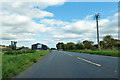
A4 Bath Road towards Hungerford
Harrow Farm and a crossroads ahead.
Image: © Robin Webster
Taken: 16 Sep 2018
0.09 miles
10
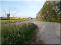
The A4 passes Harrow Farm
The buildings of Harrow Farm can be seen adjoining the A4, with a field of oilseed rape behind. Also behind the farm is the road from Ramsbury to Chisbury which crosses the A4. In the foreground is the end of a layby.
Image: © HelenK
Taken: 14 May 2021
0.12 miles