
IMAGES TAKEN NEAR TO
Mill Lane, MARLBOROUGH, SN8 2RE
Introduction
This page details the photographs taken nearby to Mill Lane, SN8 2RE by members of the Geograph project.
The Geograph project started in 2005 with the aim of publishing, organising and preserving representative images for every square kilometre of Great Britain, Ireland and the Isle of Man.

There are currently over 7.5m images from over14,400 individuals and you can help contribute to the project by visiting https://www.geograph.org.uk
Image Map
Images are licensed for reuse under creativecommons.org/licenses/by-sa/2.0
Notes
- Clicking on the map will re-center to the selected point.
- The higher the marker number, the further away the image location is from the centre of the postcode.
Image Listing (174 Images Found)
Images are licensed for reuse under creativecommons.org/licenses/by-sa/2.0
Image
Details
Distance
1
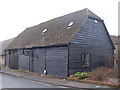
Black Barn, Ramsbury
Attractive old barn on Ramsbury's High Street, now a tasteful residential conversion.
www.ramsbury.org
Image: © Colin Smith
Taken: 1 Feb 2011
0.04 miles
2
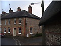
Cottages in Ramsbury
Old Georgian terraced row of flint and red brick cottages on Ramsbury's High Street.
www.ramsbury.org
Image: © Colin Smith
Taken: 1 Feb 2011
0.04 miles
3
![Ramsbury houses [24]](https://s0.geograph.org.uk/geophotos/06/44/62/6446284_6b1dbfff_120x120.jpg)
Ramsbury houses [24]
This large and somewhat pretentious property, Westfield House, was built in 1988.
Ramsbury lies in fertile farming land in the valley of the River Kennet. The site has been occupied since at least the Iron Age and there are several Roman villas. There was a bishopric of Ramsbury, established by 909 and ended in 1075 when it was included in the bishopric of Salisbury. Until 1744 when the present A4 road was turnpiked, the road through the village was part of the main route from London to Bristol.
Image: © Michael Dibb
Taken: 14 Mar 2020
0.05 miles
4
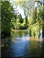
The Kennet at Ramsbury
The delightful chalk stream that is the River Kennet at Ramsbury. In recent years there have been problems with very low water levels due to groundwater extraction for drinking water and irrigation.
Image: © Gordon Hatton
Taken: 3 Jun 2010
0.05 miles
5
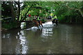
Ford and Riders at Ramsbury
This is the main ford on the River Kennet found along Mill Lane, Ramsbury.
Image: © John Walton
Taken: 16 Jun 2013
0.05 miles
6
![Ramsbury houses [25]](https://s1.geograph.org.uk/geophotos/06/44/62/6446285_8a6fb6dc_120x120.jpg)
Ramsbury houses [25]
A small cottage in the grounds of Westfield House Image
Ramsbury lies in fertile farming land in the valley of the River Kennet. The site has been occupied since at least the Iron Age and there are several Roman villas. There was a bishopric of Ramsbury, established by 909 and ended in 1075 when it was included in the bishopric of Salisbury. Until 1744 when the present A4 road was turnpiked, the road through the village was part of the main route from London to Bristol.
Image: © Michael Dibb
Taken: 14 Mar 2020
0.06 miles
7
![Ramsbury houses [20]](https://s1.geograph.org.uk/geophotos/06/44/62/6446257_a8f1b7b2_120x120.jpg)
Ramsbury houses [20]
This row of 4 cottages, odd numbers 83 to 89 High Street, is early 19th century with the right end bay added later. Listed, grade II, with details at: https://historicengland.org.uk/listing/the-list/list-entry/1034069
Ramsbury lies in fertile farming land in the valley of the River Kennet. The site has been occupied since at least the Iron Age and there are several Roman villas. There was a bishopric of Ramsbury, established by 909 and ended in 1075 when it was included in the bishopric of Salisbury. Until 1744 when the present A4 road was turnpiked, the road through the village was part of the main route from London to Bristol.
Image: © Michael Dibb
Taken: 14 Mar 2020
0.06 miles
8
![Ramsbury buildings [10]](https://s0.geograph.org.uk/geophotos/06/44/74/6447448_43446e7d_120x120.jpg)
Ramsbury buildings [10]
The Old Barn in High Street, possibly once part of Westfield Farm, has been converted into living accommodation.
Ramsbury lies in fertile farming land in the valley of the River Kennet. The site has been occupied since at least the Iron Age and there are several Roman villas. There was a bishopric of Ramsbury, established by 909 and ended in 1075 when it was included in the bishopric of Salisbury. Until 1744 when the present A4 road was turnpiked, the road through the village was part of the main route from London to Bristol.
Image: © Michael Dibb
Taken: 14 Mar 2020
0.06 miles
9
![Ramsbury houses [23]](https://s3.geograph.org.uk/geophotos/06/44/62/6446275_586b76b0_120x120.jpg)
Ramsbury houses [23]
This house at number 82 High Street has had the top floor added at some later date.
Ramsbury lies in fertile farming land in the valley of the River Kennet. The site has been occupied since at least the Iron Age and there are several Roman villas. There was a bishopric of Ramsbury, established by 909 and ended in 1075 when it was included in the bishopric of Salisbury. Until 1744 when the present A4 road was turnpiked, the road through the village was part of the main route from London to Bristol.
Image: © Michael Dibb
Taken: 14 Mar 2020
0.06 miles
10
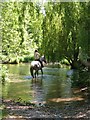
Fording the Kennet
The Kennet drains much of the water from the Marlborough Downs, flowing eastwards through Ramsbury on its way to join the Thames at Reading.
Image: © Gordon Hatton
Taken: 3 Jun 2010
0.07 miles