
IMAGES TAKEN NEAR TO
Newtown, MARLBOROUGH, SN8 2QD
Introduction
This page details the photographs taken nearby to Newtown, SN8 2QD by members of the Geograph project.
The Geograph project started in 2005 with the aim of publishing, organising and preserving representative images for every square kilometre of Great Britain, Ireland and the Isle of Man.

There are currently over 7.5m images from over14,400 individuals and you can help contribute to the project by visiting https://www.geograph.org.uk
Image Map
Images are licensed for reuse under creativecommons.org/licenses/by-sa/2.0
Notes
- Clicking on the map will re-center to the selected point.
- The higher the marker number, the further away the image location is from the centre of the postcode.
Image Listing (9 Images Found)
Images are licensed for reuse under creativecommons.org/licenses/by-sa/2.0
Image
Details
Distance
1
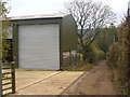
Byway at New Town
Loose-surfaced track on the eastern edge of Ramsbury, passing by a large, modern barn.
www.ramsbury.org
Image: © Colin Smith
Taken: 1 Feb 2011
0.14 miles
2

Newtown Road
Heading east out of Ramsbury - the village sign is on the right.
Image: © Robin Webster
Taken: 13 Jan 2023
0.15 miles
3

The Orange Way in Wiltshire (418)
There's a bend in the track before West Lodge is reached.
Image: © Shazz
Taken: 4 Jun 2013
0.16 miles
4

House on Newtown Road, New Town
The barn on the right was built after 2011
Image: © David Howard
Taken: 21 Aug 2016
0.16 miles
5
![Ramsbury houses [61]](https://s1.geograph.org.uk/geophotos/06/45/06/6450677_d39c5175_120x120.jpg)
Ramsbury houses [61]
Brookside in Newtown Road is 17th century with a 20th century rear wing. The timber framed and thatched detached cottage is listed, grade II, with details at: https://historicengland.org.uk/listing/the-list/list-entry/1300406
Ramsbury lies in fertile farming land in the valley of the River Kennet. The site has been occupied since at least the Iron Age and there are several Roman villas. There was a bishopric of Ramsbury, established by 909 and ended in 1075 when it was included in the bishopric of Salisbury. Until 1744 when the present A4 road was turnpiked, the road through the village was part of the main route from London to Bristol.
Image: © Michael Dibb
Taken: 14 Mar 2020
0.17 miles
6
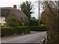
Newtown Road, Ramsbury
Main road leading east out of the Kennet Valley village of Ramsbury - with another example of local thatching.
www.ramsbury.org
Image: © Colin Smith
Taken: 1 Feb 2011
0.19 miles
7

Ramsbury STW
Part of Thames Water's Ramsbury Sewage Works site.
Image: © Des Blenkinsopp
Taken: 7 Apr 2010
0.24 miles
9
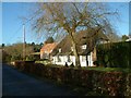
![Ramsbury houses [62]](https://s1.geograph.org.uk/geophotos/06/45/06/6450681_3f4a88eb_120x120.jpg)
Ramsbury houses [62]
Rush Cottage is early/mid 19th century in diaper brickwork. There is a fine Oeil de boeuf over the door. Listed, grade II, with details at: https://historicengland.org.uk/listing/the-list/list-entry/1034100
Ramsbury lies in fertile farming land in the valley of the River Kennet. The site has been occupied since at least the Iron Age and there are several Roman villas. There was a bishopric of Ramsbury, established by 909 and ended in 1075 when it was included in the bishopric of Salisbury. Until 1744 when the present A4 road was turnpiked, the road through the village was part of the main route from London to Bristol.
Image: © Michael Dibb
Taken: 14 Mar 2020
0.25 miles