IMAGES TAKEN NEAR TO
Lamplands, MARLBOROUGH, SN8 2PW
Introduction
This page details the photographs taken nearby to Lamplands, SN8 2PW by members of the Geograph project.
The Geograph project started in 2005 with the aim of publishing, organising and preserving representative images for every square kilometre of Great Britain, Ireland and the Isle of Man.

There are currently over 7.5m images from over14,400 individuals and you can help contribute to the project by visiting https://www.geograph.org.uk
Image Map
Images are licensed for reuse under creativecommons.org/licenses/by-sa/2.0
Notes
- Clicking on the map will re-center to the selected point.
- The higher the marker number, the further away the image location is from the centre of the postcode.
Image Listing (48 Images Found)
Images are licensed for reuse under creativecommons.org/licenses/by-sa/2.0
Image
Details
Distance
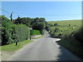
2
The Orange Way in Wiltshire (416)
The bridleway crosses the minor road going south from Ramsbury.
Image: © Shazz
Taken: 4 Jun 2013
0.02 miles
3
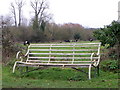
Rest a while, Ramsbury
This seat is beside the road near the River Kennet. Perhaps it would be nicer if it faced the water meadows. The cattle in the distance are Belted Galloways.
Image: © Maigheach-gheal
Taken: 5 Mar 2011
0.03 miles
4

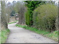
Bridleway, Ramsbury
The bridleway takes riders and walkers towards West Lodge and beyond.
Image: © Maigheach-gheal
Taken: 5 Mar 2011
0.04 miles
5
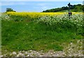
The Orange Way in Wiltshire (417)
The bridleway to the right has an unusual sign. The Orange Way continues ahead (to the left of the oilseed crop).
Image: © Shazz
Taken: 4 Jun 2013
0.04 miles
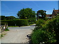
6
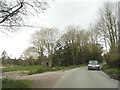
The road to Ramsbury
About to cross the River Kennet into the village
Image: © David Howard
Taken: 24 Apr 2016
0.06 miles
7
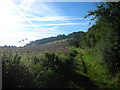
Bridleway, Ramsbury
The bridleway takes walkers and riders westwards along the Kennet valley.
Image: © Maigheach-gheal
Taken: 5 Mar 2011
0.08 miles
9
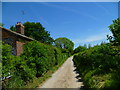
The Orange Way in Wiltshire (415)
The bridleway continues east.
Image: © Shazz
Taken: 4 Jun 2013
0.11 miles
10

The Kennet at Ramsbury
Wide "chalk stream" flowing through the Wiltshire Downland village of Ramsbury.
www.ramsbury.org
Image: © Colin Smith
Taken: 1 Feb 2011
0.13 miles