
IMAGES TAKEN NEAR TO
Southend, MARLBOROUGH, SN8 1SG
Introduction
This page details the photographs taken nearby to Southend, SN8 1SG by members of the Geograph project.
The Geograph project started in 2005 with the aim of publishing, organising and preserving representative images for every square kilometre of Great Britain, Ireland and the Isle of Man.

There are currently over 7.5m images from over14,400 individuals and you can help contribute to the project by visiting https://www.geograph.org.uk
Image Map
Images are licensed for reuse under creativecommons.org/licenses/by-sa/2.0
Notes
- Clicking on the map will re-center to the selected point.
- The higher the marker number, the further away the image location is from the centre of the postcode.
Image Listing (23 Images Found)
Images are licensed for reuse under creativecommons.org/licenses/by-sa/2.0
Image
Details
Distance
1

Closed road, near A345, Ogbourne St George, Wiltshire
This short stretch of road was once the part of the main road until it was by-passed about thirty years ago. The milestone does not appear on the 1:50000 map but does on the 1:25000 edition.
Image: © Brian Robert Marshall
Taken: 11 Feb 2007
0.06 miles
2
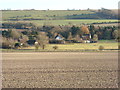
Cottages, Southend
Thatched cottages in the hamlet of Southend, seen from the byway above the Og valley (this photo was taken with a slight zoom).
Image: © Vieve Forward
Taken: 19 Jan 2015
0.06 miles
3

Tollgate Cottage by the A345, Ogbourne St George
Southend by the A345, in parish of Ogbourne St George (Kennet District), Tollgate Cottage, Southend, SN8 1SG.
Grade II listed.
List Entry Number: 1182531 https://historicengland.org.uk/listing/the-list/list-entry/1182531
Surveyed
Milestone Society National ID: WI.OGB
Image: © Alan Rosevear
Taken: 19 Jul 2013
0.07 miles

5

A346 towards Swindon
Entering Southend, which seems to be the south end of Ogbourne St George, which is otherwise bypassed by the A346.
Image: © Robin Webster
Taken: 9 Jan 2022
0.08 miles
6

View east from the A345 near Ogbourne St George
The crop is just starting to germinate. The house at the centre-left of the image is at SU205734. The mast on the skyline must be fairly new as it does not yet appear on the maps.
Image: © Brian Robert Marshall
Taken: 11 Feb 2007
0.11 miles
7

Junction on A346 for access to Ogbourne St George
Image: © David Smith
Taken: 27 Dec 2010
0.14 miles
8

Sheep and lambs, Southend, near Marlborough
I'd stopped at this point as I'd spotted a buzzard. The buzzard had long gone by the time I had my camera ready. These nearby sheep were making a lot of noise and, when they saw me, came running towards me, presumably hoping for food. Unable to oblige I'm afraid. There was a pile of earth in the corner of the field, which the sheep seemed to enjoy using as an adventure playground.
Image: © Brian Robert Marshall
Taken: 2 Apr 2007
0.15 miles
9

Milestone on A345 near Ogbourne St George, Wiltshire
Close-up of the milestone. It has a benchmark but no indication as to the height it represents. The cut mark was levelled by the Ordnance Survey in 1967 at a height of 143.6614m above Newlyn datum and is included in the Bench Mark Database here http://www.bench-marks.org.uk/bm33439
Image: © Brian Robert Marshall
Taken: 11 Feb 2007
0.15 miles
10

Old Milestone by the A346, Ogbourne St George
Swindon thin 'D' stone by the A346, in parish of Ogbourne St George (Kennet District), Southend; junction of old road and by-pass, by the access to Hallam Farm buildings, in hedge to right of gate.
Inscription reads:-
: TO / SWINDON / 8 / Miles : : TO / MARLBRO / 3 / Miles :
Carved benchmark on centre face.
Grade II listed.
List Entry Number: 1284490 https://historicengland.org.uk/listing/the-list/list-entry/1284490
Milestone Society National ID: WI_MLSN03
Image: © Zak La Gumina
Taken: 22 Aug 2021
0.16 miles