
IMAGES TAKEN NEAR TO
Copse Drove, MARLBOROUGH, SN8 1RW
Introduction
This page details the photographs taken nearby to Copse Drove, SN8 1RW by members of the Geograph project.
The Geograph project started in 2005 with the aim of publishing, organising and preserving representative images for every square kilometre of Great Britain, Ireland and the Isle of Man.

There are currently over 7.5m images from over14,400 individuals and you can help contribute to the project by visiting https://www.geograph.org.uk
Image Map
Images are licensed for reuse under creativecommons.org/licenses/by-sa/2.0
Notes
- Clicking on the map will re-center to the selected point.
- The higher the marker number, the further away the image location is from the centre of the postcode.
Image Listing (22 Images Found)
Images are licensed for reuse under creativecommons.org/licenses/by-sa/2.0
Image
Details
Distance
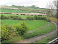
3
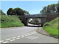
Bypass bridge, Ogbourne St George
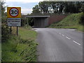
The A346 now avoids the centre of Ogbourne St George via a bypass. Originally the main road would have run closer to the camera, and turned to run under where the bridge now is. The bridge also marks where the railway line from Marlborough to Swindon formerly ran.
Image: © Phil Champion
Taken: 7 Sep 2006
0.12 miles
4
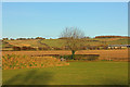
Ogbourne St George
Field adjoining a property on the edge of Ogbourne St George.
Image: © Wayland Smith
Taken: 23 Nov 2013
0.13 miles
5
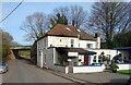
The Inn With The Well
Ogbourne St George's village inn offers fulfilling food, boisterous beers and relaxing rooms, it says on the wall.
There is indeed a well, through the door and under a glass plate on the right. The single storey bit is a more recent extension and the well would have originally been outside in a yard.
No info on the rooms, but my pint from Ramsbury Brewery was most pleasantly boisterous.
Image: © Des Blenkinsopp
Taken: 11 Feb 2022
0.13 miles
6
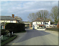
The Inn With the Well, Ogbourne St George
Image: © Stuart Logan
Taken: 29 Mar 2013
0.14 miles
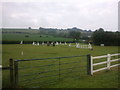
8
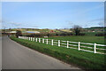
White Fence by an Ancient Route
The last straight bit of an old Roman Road which loses its way briefly at Ogbourne St George before carrying on northwards as the busy A346 towards Swindon.
Image: © Des Blenkinsopp
Taken: 11 Feb 2022
0.17 miles
9
![Ogbourne St George buildings [3]](https://s0.geograph.org.uk/geophotos/07/41/06/7410632_9db980a9_120x120.jpg)
Ogbourne St George buildings [3]
The former village stores and post office, High Street, is now a private dwelling. The business became tearooms circa 1990 and closed completely circa 1999. Constructed of red brick under a tile roof.
Ogbourne St George is a village in the valley of the River Og in Wiltshire. It is sited just off the Roman Road from Cirencester to Winchester, about 7 miles south of Swindon and some 3¼ miles north of Marlborough. The name derives from the Saxon 'Oceburnan' or 'Oc[c]a's stream'. There is a great deal of evidence of prehistoric, Roman and medieval activity including Neolithic flint tools, Iron Age coins, Romano-British coins and pottery and medieval pottery fragments. Ogbourne St George today is a commuter village.
Image: © Michael Dibb
Taken: 27 Jan 2023
0.18 miles
10
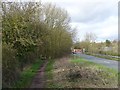
Ogbourne railway station (site), Wiltshire
Opened in 1881 by the Swindon Marlborough and Andover Railway, later part of the Midland & South Western Junction Railway, this station closed to passengers in 1961.
View north west towards Chiseldon Camp and Swindon. The track-bed was roughly where the path now is and the camera position is near the southern end of the two platforms.
Image: © Nigel Thompson
Taken: 14 Mar 2019
0.18 miles