IMAGES TAKEN NEAR TO
Beckhampton, MARLBOROUGH, SN8 1QU
Introduction
This page details the photographs taken nearby to SN8 1QU by members of the Geograph project.
The Geograph project started in 2005 with the aim of publishing, organising and preserving representative images for every square kilometre of Great Britain, Ireland and the Isle of Man.

There are currently over 7.5m images from over14,400 individuals and you can help contribute to the project by visiting https://www.geograph.org.uk
Image Map
Images are licensed for reuse under creativecommons.org/licenses/by-sa/2.0
Notes
- Clicking on the map will re-center to the selected point.
- The higher the marker number, the further away the image location is from the centre of the postcode.
Image Listing (46 Images Found)
Images are licensed for reuse under creativecommons.org/licenses/by-sa/2.0
Image
Details
Distance
1
![A circular walk on the Downs from Avebury [5]](https://s0.geograph.org.uk/geophotos/06/47/06/6470672_7c5210d9_120x120.jpg)
A circular walk on the Downs from Avebury [5]
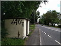
Seen from Beckhampton Road, A4361, is Nash Road which is a public bridleway leading to Avebury Trusloe.
The walk follows footpaths to Beckhampton and then a byway to Allington Down. A short stretch along Wansdyke before a bridleway and later a byway lead back to West Kennet. A footpath, part of the White Horse Trail, runs around Silbury Hill and back to the start. Just over 7½ miles.
Image: © Michael Dibb
Taken: 16 Apr 2020
0.03 miles
2
![A circular walk on the Downs from Avebury [6]](https://s1.geograph.org.uk/geophotos/06/47/06/6470673_ade016d0_120x120.jpg)
A circular walk on the Downs from Avebury [6]
Seen from Beckhampton Road. A4361, this short bridleway runs to the A4 road.
The walk follows footpaths to Beckhampton and then a byway to Allington Down. A short stretch along Wansdyke before a bridleway and later a byway lead back to West Kennet. A footpath, part of the White Horse Trail, runs around Silbury Hill and back to the start. Just over 7½ miles.
Image: © Michael Dibb
Taken: 16 Apr 2020
0.05 miles
3
![A circular walk on the Downs from Avebury [4]](https://s3.geograph.org.uk/geophotos/06/47/06/6470671_2776732c_120x120.jpg)
A circular walk on the Downs from Avebury [4]
Beckhampton Stables on the corner of Nash Road.
The walk follows footpaths to Beckhampton and then a byway to Allington Down. A short stretch along Wansdyke before a bridleway and later a byway lead back to West Kennet. A footpath, part of the White Horse Trail, runs around Silbury Hill and back to the start. Just over 7½ miles.
Image: © Michael Dibb
Taken: 16 Apr 2020
0.07 miles
4
![A circular walk on the Downs from Avebury [3]](https://s2.geograph.org.uk/geophotos/06/47/06/6470670_0e335e58_120x120.jpg)
A circular walk on the Downs from Avebury [3]
An information board in Nash Road about the Long Stones, known as Adam and Eve. See Image The stones are a Scheduled Ancient Monument with details at: https://historicengland.org.uk/listing/the-list/list-entry/1008104 The stones are part of the Stonehenge, Avebury and Associated Sites World Heritage Site with details at: https://historicengland.org.uk/listing/the-list/list-entry/1000097
The walk follows footpaths to Beckhampton and then a byway to Allington Down. A short stretch along Wansdyke before a bridleway and later a byway lead back to West Kennet. A footpath, part of the White Horse Trail, runs around Silbury Hill and back to the start. Just over 7½ miles.
Image: © Michael Dibb
Taken: 16 Apr 2020
0.08 miles
5
![A circular walk on the Downs from Avebury [7]](https://s2.geograph.org.uk/geophotos/06/47/06/6470674_776c98e1_120x120.jpg)
A circular walk on the Downs from Avebury [7]
This odd and overgrown building is seen from the bridleway.
The walk follows footpaths to Beckhampton and then a byway to Allington Down. A short stretch along Wansdyke before a bridleway and later a byway lead back to West Kennet. A footpath, part of the White Horse Trail, runs around Silbury Hill and back to the start. Just over 7½ miles.
Image: © Michael Dibb
Taken: 16 Apr 2020
0.09 miles
8
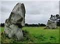
Beckhampton Avenue
The stone in the foreground forms part of the stone row and the one beyond part of a setting. The double row once extended from here to the henge at Avebury. https://stonerows.wordpress.com/gazetteer/region/rest-of-england/beckhampton-avenue/
Image: © Sandy Gerrard
Taken: 7 Aug 2016
0.12 miles
9
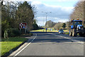
A4 heading west
Approaching the A361/A4361 roundabout.
Image: © Robin Webster
Taken: 2 Feb 2018
0.12 miles