1
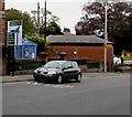
New Road directions sign, Marlborough
Facing the A4 New Road on the approach to the roundabout at the A346 junction.
Image: © Jaggery
Taken: 14 Oct 2017
0.01 miles
2
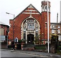
Christchurch Methodist & United Reformed Church
George Pocock certified a Methodist chapel in Oxford Street Which is just behind this building. In 1872 the chapel was extended and was rebuilt in 1910 with the entrance in New Road (the entrance you can see here) and from then on was called the New Road Chapel. The United Reformed Church closed in 1984 and the two churches united in the newly designed Christchurch (the former Methodist chapel) where the first service was held on 21st October 1984.
Image: © Nigel Mykura
Taken: 23 Jun 2013
0.01 miles
3
Christchurch, Marlborough
The church is a joint Methodist and United Reformed Church.
Image: © nick macneill
Taken: 15 Oct 2012
0.01 miles
4
Marlborough buildings [12]
The rear of these two buildings, Marlborough Methodist church and Marlborough Masonic Hall which face onto New Road (A4), are seen in Oxford Street. The church was founded in 1811, the hall about the same time. The hall is listed, grade II, with details at: https://www.historicengland.org.uk/listing/the-list/list-entry/1243032
Marlborough is a market town on the Old Bath Road once the main road from London to Bath. The twice-weekly market is sited in High Street, one of the widest in England, lined on both sides with fine listed buildings of which the town has almost 300. There is evidence of local settlement from every period from the prehistoric to the present day. The town is home to the renowned Marlborough College. The River Kennet flows through the town.
Image: © Michael Dibb
Taken: 17 Jul 2017
0.01 miles
5
New Road, Marlborough
Exemplifies the town's traffic problems; a major north-south route, the A346 intersects the east-west A4 at the roundabout ahead.
Image: © Jonathan Billinger
Taken: 9 Sep 2016
0.01 miles
6
Christ Church, Marlborough
Image: © David Howard
Taken: 11 Mar 2018
0.01 miles
7
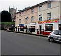
Kebab & Pizza House in Marlborough
Fast food takeaway at 8 New Road Marlborough.
Image: © Jaggery
Taken: 14 Oct 2017
0.02 miles
8
Pilates Plus, Marlborough
Physiotherapy & Pilates studio in Oxford Street. Pilates is a physical fitness system developed in the early 20th century by German physical trainer Joseph Pilates (1883-1967).
Image: © Jaggery
Taken: 14 Oct 2017
0.02 miles
9
Marlborough houses [66]
Numbers 8 and 9 The Parade are a pair of 18th century timber framed and plastered houses. Number 9 has a very tall chimney stack in diapered brick and number 8 has an oblong shop front. Listed, grade II, with details at: https://historicengland.org.uk/listing/the-list/list-entry/1243088
Marlborough is a market town on the Old Bath Road once the main road from London to Bath. The twice-weekly market is sited in High Street, one of the widest in England, lined on both sides with fine listed buildings of which the town has almost 300. There is evidence of local settlement from every period from the prehistoric to the present day. The town is home to the renowned Marlborough College. The River Kennet flows through the town.
Image: © Michael Dibb
Taken: 27 Nov 2020
0.02 miles
10
Marlborough buildings [51]
Now a restaurant known as Dans at The Crown, this is the former Crown Hotel, numbers 6 and 7 The Parade. Built in the 18th century in a mix of red brick and vitreous brick with red dressings. There is a long rear wing. Listed, grade II, with details at: https://historicengland.org.uk/listing/the-list/list-entry/1243042
Marlborough is a market town on the Old Bath Road once the main road from London to Bath. The twice-weekly market is sited in High Street, one of the widest in England, lined on both sides with fine listed buildings of which the town has almost 300. There is evidence of local settlement from every period from the prehistoric to the present day. The town is home to the renowned Marlborough College. The River Kennet flows through the town.
Image: © Michael Dibb
Taken: 27 Nov 2020
0.02 miles


![Marlborough buildings [12]](https://s3.geograph.org.uk/geophotos/05/46/63/5466399_3f7ec6a4_120x120.jpg)


![Marlborough houses [66]](https://s3.geograph.org.uk/geophotos/06/76/59/6765975_fc5464ca_120x120.jpg)
![Marlborough buildings [51]](https://s0.geograph.org.uk/geophotos/06/76/59/6765968_d4ef4afa_120x120.jpg)