Marlborough buildings [51]
Introduction
The photograph on this page of Marlborough buildings [51] by Michael Dibb as part of the Geograph project.
The Geograph project started in 2005 with the aim of publishing, organising and preserving representative images for every square kilometre of Great Britain, Ireland and the Isle of Man.

There are currently over 7.5m images from over 14,400 individuals and you can help contribute to the project by visiting https://www.geograph.org.uk
Marlborough buildings [51]
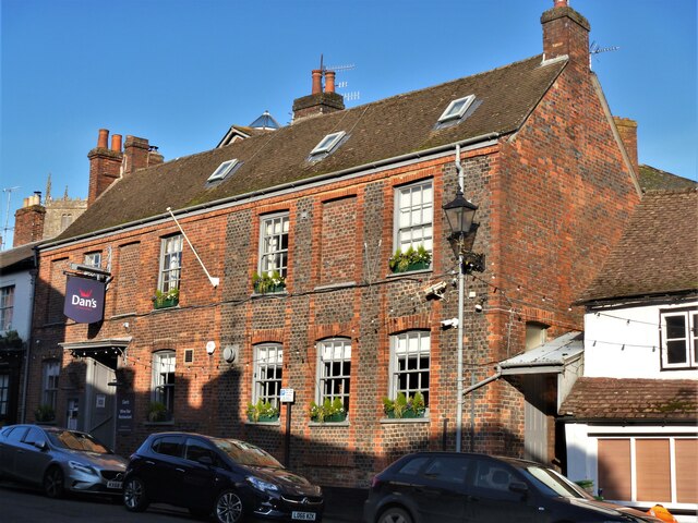
Image: © Michael Dibb Taken: 27 Nov 2020
Now a restaurant known as Dans at The Crown, this is the former Crown Hotel, numbers 6 and 7 The Parade. Built in the 18th century in a mix of red brick and vitreous brick with red dressings. There is a long rear wing. Listed, grade II, with details at: https://historicengland.org.uk/listing/the-list/list-entry/1243042 Marlborough is a market town on the Old Bath Road once the main road from London to Bath. The twice-weekly market is sited in High Street, one of the widest in England, lined on both sides with fine listed buildings of which the town has almost 300. There is evidence of local settlement from every period from the prehistoric to the present day. The town is home to the renowned Marlborough College. The River Kennet flows through the town.
Images are licensed for reuse under creativecommons.org/licenses/by-sa/2.0
Image Location
Latitude
51.421139
Longitude
-1.728719