
IMAGES TAKEN NEAR TO
Windrush, SWINDON, SN6 7DZ
Introduction
This page details the photographs taken nearby to Windrush, SN6 7DZ by members of the Geograph project.
The Geograph project started in 2005 with the aim of publishing, organising and preserving representative images for every square kilometre of Great Britain, Ireland and the Isle of Man.

There are currently over 7.5m images from over14,400 individuals and you can help contribute to the project by visiting https://www.geograph.org.uk
Image Map
Images are licensed for reuse under creativecommons.org/licenses/by-sa/2.0
Notes
- Clicking on the map will re-center to the selected point.
- The higher the marker number, the further away the image location is from the centre of the postcode.
Image Listing (29 Images Found)
Images are licensed for reuse under creativecommons.org/licenses/by-sa/2.0
Image
Details
Distance
1
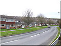
Housing estates
The Hampton Hill part of Highworth, developed in the 1960's and 70's.
Image: © Jonathan Billinger
Taken: 4 Jan 2007
0.03 miles
2
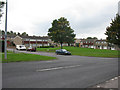
Northern end of Windrush from St Michael's Avenue
Image: © Nick Smith
Taken: 24 Sep 2011
0.06 miles
3
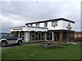
The Goldfinger Tavern
Estate pub in Highworth.
Image: © Jonathan Billinger
Taken: 4 Jan 2007
0.10 miles
4
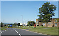
St Michael's Avenue, Highworth
The main neighbourhood road, it loops round connecting all the residential no through roads which make up this area.
Image: © Des Blenkinsopp
Taken: 8 Aug 2020
0.10 miles
5
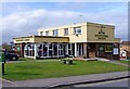
Goldfinger Tavern, Newburgh Place, Highworth
A typical estate pub of the 1960's, with a flat roof. It is surrounded by the Home Farm and Windrush estates, in the west of Highworth. It has had a chequered history, with at times a rapid turnover of managers. For some years it has been owned by the Greene King brewery of Sudbury, Suffolk, which hopefully has brought some stability. It recently underwent a makeover.
Image: © P L Chadwick
Taken: 11 Mar 2011
0.11 miles
6
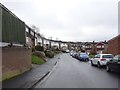
Highworth railway station (site), Wiltshire
Opened in 1883 by the Great Western Railway as the terminus of a branch line from Swindon, this station closed to passengers in 1953 and completely in 1962.
View south west towards Hannington and Swindon, from a similar viewpoint to Image The road known as Windrush appears to follow the track of the former railway at this point. No trace of the former station appears to remain here but the station sign does - see Image
Image: © Nigel Thompson
Taken: 31 Mar 2018
0.11 miles
8
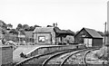
Highworth station, 1950
View eastward to the buffer-stops of the terminus of the ex-GWR branch from Swindon (Highworth Junction), closed to passengers 2/3/53, to goods 6/8/62. (See also my Image).
Image: © Walter Dendy, deceased
Taken: 24 Sep 1950
0.13 miles
10
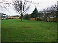
Village Green, St Michael's Avenue, Highworth, Swindon
This is a fairly routine image of a what might appear to be a pleasant but unremarkable area of public open space. However, there is more, much more to it than that. The tale begins in the late 1960s when the area of land west of the A361 in Highworth became subject to a planning permission to develop the land as a housing estate. In due course construction commenced and the area known locally as 'Windrush' came into existence. At some point in the 1970s the developers ceased trading. Nothing unusual in that except that, in this case, it happened before all the normal post-development loose ends such as adoption of roads, sewers and public open spaces had been tied up. The effect was that the areas of de facto 'public open space' i.e. areas of land not clearly associated with buildings, were, apparently, owned by an entity that no longer existed. This oddity notwithstanding the local authority started and continued to maintain the land by cutting the grass and other landscaping-type tasks. It isn't clear exactly when what happened next took place (it was post-December 2007 if Google Earth is to be believed) but it seems a collective decision was taken by some residents in houses in Barra Close that backed onto the space to assume possession of part of the land. This was accomplished by engaging a fencing contractor to build a fence around the part of the land immediately behind their houses. From a local resident whom I spoke to I gather that the fencing contractor completed the task within a day. In due course, and hardly unexpectedly, some residents not party to the land acquisition enterprise complained to the local planning authority. This culminated in a planning application being submitted and duly considered before being rejected. Two things flowed from this. First and predictably, the applicants' appealed to the relevant central government department and second, the other residents applied to have the land declared to be a 'village green' within the meaning of the Commons Act 2006. For the moment then the fence remains, visible in this image as the light-coloured section of fence in the centre of the image and the fence leading away from it. However on the 27th January 2010 the local authority granted village green status to the land in view - except the land appropriated as described above. If the planning appeal fails and those in possession of it hand it back, a further application to include the land as village green will probably be made. A local newspaper report on the village green application can be read here http://www.swindonadvertiser.co.uk/news/4876066.Partial_victory_over_green_area/ For a closer look at the fence please see this image Image
It's different now (Sept 2010) http://www.geograph.org.uk/photo/2078855
Image: © Brian Robert Marshall
Taken: 28 Jan 2010
0.13 miles