
IMAGES TAKEN NEAR TO
Collett Place, SWINDON, SN6 6EH
Introduction
This page details the photographs taken nearby to Collett Place, SN6 6EH by members of the Geograph project.
The Geograph project started in 2005 with the aim of publishing, organising and preserving representative images for every square kilometre of Great Britain, Ireland and the Isle of Man.

There are currently over 7.5m images from over14,400 individuals and you can help contribute to the project by visiting https://www.geograph.org.uk
Image Map
Images are licensed for reuse under creativecommons.org/licenses/by-sa/2.0
Notes
- Clicking on the map will re-center to the selected point.
- The higher the marker number, the further away the image location is from the centre of the postcode.
Image Listing (52 Images Found)
Images are licensed for reuse under creativecommons.org/licenses/by-sa/2.0
Image
Details
Distance
1
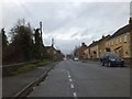
Modern houses in The Street at Latton
Latton is on the former route of the A419, and The Street follows the Roman road. The traffic calming measures are more recent than the Roman period.
Image: © David Smith
Taken: 28 Dec 2012
0.02 miles
2
![A circular walk around Cricklade [43]](https://s1.geograph.org.uk/geophotos/06/33/90/6339053_d98accd2_120x120.jpg)
A circular walk around Cricklade [43]
With its gable facing the road, part of Elm Farmhouse is 17th century. The wing parallel to the road is 18th century. Listed, grade II, with details at: https://historicengland.org.uk/listing/the-list/list-entry/1183386
Starting in the town of Cricklade, the walk passes through Latton and Eysey before following the River Thames back to Cricklade.
Image: © Michael Dibb
Taken: 25 Aug 2019
0.06 miles
3
![A circular walk around Cricklade [42]](https://s0.geograph.org.uk/geophotos/06/33/90/6339052_929615d5_120x120.jpg)
A circular walk around Cricklade [42]
With its gable facing the road, this part of Elm Farmhouse is 17th century. The wing parallel to the road is 18th century. Listed, grade II, with details at: https://historicengland.org.uk/listing/the-list/list-entry/1183386
Starting in the town of Cricklade, the walk passes through Latton and Eysey before following the River Thames back to Cricklade.
Image: © Michael Dibb
Taken: 25 Aug 2019
0.06 miles
4
![A circular walk around Cricklade [44]](https://s2.geograph.org.uk/geophotos/06/33/90/6339054_443b5674_120x120.jpg)
A circular walk around Cricklade [44]
The delightful Bowron Cottage is 18th century and is listed, grade II, with details at: https://historicengland.org.uk/listing/the-list/list-entry/1356078
Starting in the town of Cricklade, the walk passes through Latton and Eysey before following the River Thames back to Cricklade.
Image: © Michael Dibb
Taken: 25 Aug 2019
0.07 miles
5
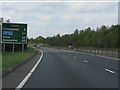
A419 - route confirmatory sign near Latton
The bottom two destinations should really be in parentheses (like the (M5) example) as they are not directly served by the A419.
Image: © J Whatley
Taken: 22 Sep 2010
0.08 miles
8
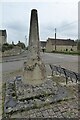
Old cross
Old medieval preaching or wayside cross in Latton. The cross is Grade II listed, see: https://historicengland.org.uk/listing/the-list/list-entry/1284078?section=official-list-entry
Image: © Philip Halling
Taken: 3 May 2022
0.08 miles
10
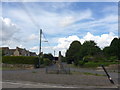
![A circular walk around Cricklade [41]](https://s1.geograph.org.uk/geophotos/06/33/90/6339049_8154efc7_120x120.jpg)
A circular walk around Cricklade [41]
This medieval wayside or preaching cross is located alongside the Roman Ermin Way (or Ermin Street) which linked Glevum (Gloucester) and Corinium (Cirencester) to Calleva (Silchester). The road, once the A419, is now unclassified. The cross was damaged in 1982 and the upturned end of the shattered cross is said to have borne Roman lettering, perhaps originally a milestone. Listed, grade II, with details at: https://historicengland.org.uk/listing/the-list/list-entry/1284078 and a Scheduled Ancient Monument with details at: https://historicengland.org.uk/listing/the-list/list-entry/1004722
Starting in the town of Cricklade, the walk passes through Latton and Eysey before following the River Thames back to Cricklade.
Image: © Michael Dibb
Taken: 25 Aug 2019
0.09 miles