A circular walk around Cricklade [41]
Introduction
The photograph on this page of A circular walk around Cricklade [41] by Michael Dibb as part of the Geograph project.
The Geograph project started in 2005 with the aim of publishing, organising and preserving representative images for every square kilometre of Great Britain, Ireland and the Isle of Man.

There are currently over 7.5m images from over 14,400 individuals and you can help contribute to the project by visiting https://www.geograph.org.uk
A circular walk around Cricklade [41]
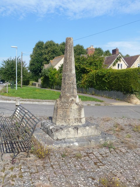
Image: © Michael Dibb Taken: 25 Aug 2019
This medieval wayside or preaching cross is located alongside the Roman Ermin Way (or Ermin Street) which linked Glevum (Gloucester) and Corinium (Cirencester) to Calleva (Silchester). The road, once the A419, is now unclassified. The cross was damaged in 1982 and the upturned end of the shattered cross is said to have borne Roman lettering, perhaps originally a milestone. Listed, grade II, with details at: https://historicengland.org.uk/listing/the-list/list-entry/1284078 and a Scheduled Ancient Monument with details at: https://historicengland.org.uk/listing/the-list/list-entry/1004722 Starting in the town of Cricklade, the walk passes through Latton and Eysey before following the River Thames back to Cricklade.
Images are licensed for reuse under creativecommons.org/licenses/by-sa/2.0
Image Location
Latitude
51.658573
Longitude
-1.869989