
IMAGES TAKEN NEAR TO
Courtfields, SWINDON, SN6 6EG
Introduction
This page details the photographs taken nearby to Courtfields, SN6 6EG by members of the Geograph project.
The Geograph project started in 2005 with the aim of publishing, organising and preserving representative images for every square kilometre of Great Britain, Ireland and the Isle of Man.

There are currently over 7.5m images from over14,400 individuals and you can help contribute to the project by visiting https://www.geograph.org.uk
Image Map
Images are licensed for reuse under creativecommons.org/licenses/by-sa/2.0
Notes
- Clicking on the map will re-center to the selected point.
- The higher the marker number, the further away the image location is from the centre of the postcode.
Image Listing (42 Images Found)
Images are licensed for reuse under creativecommons.org/licenses/by-sa/2.0
Image
Details
Distance
1
![A circular walk around Cricklade [55]](https://s1.geograph.org.uk/geophotos/06/34/09/6340925_1e79cb58_120x120.jpg)
A circular walk around Cricklade [55]
Seen from the footpath is this distant view of houses in Latton.
Starting in the town of Cricklade, the walk passes through Latton and Eysey before following the River Thames back to Cricklade.
Image: © Michael Dibb
Taken: 25 Aug 2019
0.07 miles
2
![A circular walk around Cricklade [52]](https://s2.geograph.org.uk/geophotos/06/33/90/6339074_9affceba_120x120.jpg)
A circular walk around Cricklade [52]
Recently built housing on the site of Church Farm.
Starting in the town of Cricklade, the walk passes through Latton and Eysey before following the River Thames back to Cricklade.
Image: © Michael Dibb
Taken: 25 Aug 2019
0.12 miles
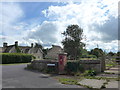
4
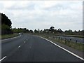
A419 - start of the Latton bypass
The highway curves away from the Roman alignment with houses on Ermin Way visible in the distance.
Image: © J Whatley
Taken: 22 Sep 2010
0.15 miles
5
![A circular walk around Cricklade [46]](https://s1.geograph.org.uk/geophotos/06/33/90/6339057_2024358a_120x120.jpg)
A circular walk around Cricklade [46]
A Victorian letter box in the centre of Latton village.
Starting in the town of Cricklade, the walk passes through Latton and Eysey before following the River Thames back to Cricklade.
Image: © Michael Dibb
Taken: 25 Aug 2019
0.15 miles
6
![A circular walk around Cricklade [50]](https://s3.geograph.org.uk/geophotos/06/33/90/6339067_771203a5_120x120.jpg)
A circular walk around Cricklade [50]
The churchyard of St John the Baptist contains a dozen listed monuments.
The church of St John the Baptist is 12th and 13th centuries heaviy restored 1858-63. Most of the internal fittings are 19th century. Listed, grade I, with details at: https://historicengland.org.uk/listing/the-list/list-entry/1284123
Starting in the town of Cricklade, the walk passes through Latton and Eysey before following the River Thames back to Cricklade.
Image: © Michael Dibb
Taken: 25 Aug 2019
0.15 miles
7
![A circular walk around Cricklade [51]](https://s3.geograph.org.uk/geophotos/06/33/90/6339071_5c8523cb_120x120.jpg)
A circular walk around Cricklade [51]
St Mary's, the former vicarage, is now flats. The main building is late 17th of early 18th century with a 19th century addition. Listed, grade II, with details at: https://historicengland.org.uk/listing/the-list/list-entry/1183407
Starting in the town of Cricklade, the walk passes through Latton and Eysey before following the River Thames back to Cricklade.
Image: © Michael Dibb
Taken: 25 Aug 2019
0.16 miles
8
![A circular walk around Cricklade [53]](https://s2.geograph.org.uk/geophotos/06/34/09/6340922_192b7d74_120x120.jpg)
A circular walk around Cricklade [53]
The end of the public road in Latton is the starting point for two footpaths and a bridleway. The bridleway leads to Down Ampney Road, one of the footpaths leads to The Grove and one leads to Eysey.
Starting in the town of Cricklade, the walk passes through Latton and Eysey before following the River Thames back to Cricklade.
Image: © Michael Dibb
Taken: 25 Aug 2019
0.16 miles
9
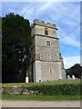
St John the Baptist church, Latton: tower
Image: © Basher Eyre
Taken: 20 Jul 2014
0.16 miles
10
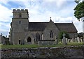
Bordering on farcical (24)
St John the Baptist church, Latton
Image: © Basher Eyre
Taken: 20 Jul 2014
0.16 miles