IMAGES TAKEN NEAR TO
Lower Pavenhill, SWINDON, SN5 4DH
Introduction
This page details the photographs taken nearby to Lower Pavenhill, SN5 4DH by members of the Geograph project.
The Geograph project started in 2005 with the aim of publishing, organising and preserving representative images for every square kilometre of Great Britain, Ireland and the Isle of Man.

There are currently over 7.5m images from over14,400 individuals and you can help contribute to the project by visiting https://www.geograph.org.uk
Image Map
Images are licensed for reuse under creativecommons.org/licenses/by-sa/2.0
Notes
- Clicking on the map will re-center to the selected point.
- The higher the marker number, the further away the image location is from the centre of the postcode.
Image Listing (11 Images Found)
Images are licensed for reuse under creativecommons.org/licenses/by-sa/2.0
Image
Details
Distance
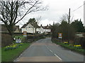
1
The Key valley, from Pavenhill, Purton
Image: © Roger Cornfoot
Taken: 8 Mar 2007
0.03 miles
2
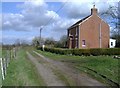
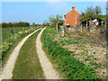
Lower Pavenhill farm
The track continues for another half mile, towards Parkgate farm.
Image: © Roger Cornfoot
Taken: 8 Mar 2007
0.09 miles
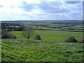
3
Lower Pavenhill, near Purton
The track in the foreground is a bridleway that leads to a farm. The valley in the distance contains the River Key, a tributary of the Thames. The Key drains into the Thames just east of Cricklade.
Image: © Brian Robert Marshall
Taken: 8 Aug 2008
0.09 miles
4
Track to Parkgate Farm, near Purton
The track is also shown on the maps as a bridleway. The cottage is part of Lower Pavenhill Farm.
Image: © Brian Robert Marshall
Taken: 2 Apr 2009
0.11 miles
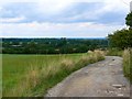
5
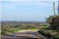
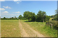
Track with a view
Also a public bridleway, one of the remarkably dense network of rights-of-way in and around Purton.
Image: © Robin Webster
Taken: 25 Mar 2017
0.12 miles
6
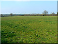
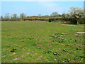
Farmland near Lower Pavenhill, Purton
Footpaths and a bridleway cross this field. The view is towards the raging torrent that is the River Key http://www.geograph.org.uk/photo/1234107
Image: © Brian Robert Marshall
Taken: 2 Apr 2009
0.12 miles
7
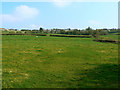
Field west of Purton
The western extremities of the village can be seen on the skyline.
Image: © Brian Robert Marshall
Taken: 2 Apr 2009
0.14 miles
8
Field and track to Parkgate Farm, near Purton
The track is visible at the right. It doubles as a bridleway.
Image: © Brian Robert Marshall
Taken: 2 Apr 2009
0.15 miles
9
Lower Pavenhill Farm
Footpath near Purton.
Image: © Wayland Smith
Taken: 30 May 2020
0.17 miles