
IMAGES TAKEN NEAR TO
Boness Road, SWINDON, SN4 9DY
Introduction
This page details the photographs taken nearby to Boness Road, SN4 9DY by members of the Geograph project.
The Geograph project started in 2005 with the aim of publishing, organising and preserving representative images for every square kilometre of Great Britain, Ireland and the Isle of Man.

There are currently over 7.5m images from over14,400 individuals and you can help contribute to the project by visiting https://www.geograph.org.uk
Image Map
Images are licensed for reuse under creativecommons.org/licenses/by-sa/2.0
Notes
- Clicking on the map will re-center to the selected point.
- The higher the marker number, the further away the image location is from the centre of the postcode.
Image Listing (13 Images Found)
Images are licensed for reuse under creativecommons.org/licenses/by-sa/2.0
Image
Details
Distance
2
Summerhouse Lane, Wroughton
Housing estate on the outskirts of Wroughton
Image: © Eirian Evans
Taken: 27 Nov 2009
0.10 miles
4
Keksboro Avenue, Wroughton
Wroughton is an old village, although much of it now dates from the second half of the 20th century.
Image: © Des Blenkinsopp
Taken: 19 Jan 2023
0.17 miles
5
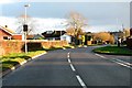
Wharf Road in Wroughton
Wharf Road (B4005) runs from Junction 16 on the M4 to the centre of Wroughton.
Image: © Steve Daniels
Taken: 9 Feb 2014
0.19 miles
6
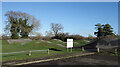
Wroughton Pump Track
Wikipedia says "A pump track is a circuit of rollers, banked turns and features designed to be ridden completely by riders "pumping" generating momentum by up and down body movements, instead of pedaling or pushing."
So nothing to do with punctures then.
The map rather coyly calls it Cycle Racing Facility.
Image: © Des Blenkinsopp
Taken: 19 Jan 2023
0.19 miles
7
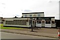
The Iron Horse on Kerrs Way
The Iron Horse is a former Morrells pub that was acquired from Whitbread as a result of the Monopolies and Mergers Commission report in 1989.
Image: © Steve Daniels
Taken: 25 Jun 2014
0.21 miles
8
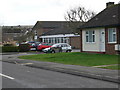
Langton House, Wroughton
Residential care home on Wharf Road.
Image: © Eirian Evans
Taken: 16 Feb 2011
0.22 miles
9
![Wroughton buildings [11]](https://s2.geograph.org.uk/geophotos/05/78/91/5789138_e141dd07_120x120.jpg)
Wroughton buildings [11]
Lansdowne Hill Care Home is located in Wharf Road.
The large village of Wroughton lies 2 miles south of Swindon at the foot of the Marlborough Downs escarpment. Two headstreams of the River Ray flow from the downs and meet in the village to run north as Wroughton Stream. There is much evidence of settlement and intensive farming of the area in the Roman period. Originally an agricultural village, most workers now commute into Swindon.
Image: © Michael Dibb
Taken: 19 May 2018
0.22 miles
10
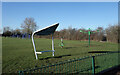
Park Scene, Wroughton
A small park off Maunsell Way on the northern edge of Wroughton.
Image: © Des Blenkinsopp
Taken: 19 Jan 2023
0.23 miles