
IMAGES TAKEN NEAR TO
Eveleigh Road, SWINDON, SN4 8AL
Introduction
This page details the photographs taken nearby to Eveleigh Road, SN4 8AL by members of the Geograph project.
The Geograph project started in 2005 with the aim of publishing, organising and preserving representative images for every square kilometre of Great Britain, Ireland and the Isle of Man.

There are currently over 7.5m images from over14,400 individuals and you can help contribute to the project by visiting https://www.geograph.org.uk
Image Map
Images are licensed for reuse under creativecommons.org/licenses/by-sa/2.0
Notes
- Clicking on the map will re-center to the selected point.
- The higher the marker number, the further away the image location is from the centre of the postcode.
Image Listing (15 Images Found)
Images are licensed for reuse under creativecommons.org/licenses/by-sa/2.0
Image
Details
Distance
2
Queen's Road at the junction of Longleaze
Image: © David Howard
Taken: 26 Oct 2019
0.10 miles
3
Longleaze at the junction of Stoneover Lane
Image: © David Howard
Taken: 26 Oct 2019
0.14 miles
4

Royal Wootton Bassett : Otter Way
A residential road.
Image: © Lewis Clarke
Taken: 4 Mar 2025
0.20 miles
5

Royal Wootton Bassett : Stoneover Lane
Looking along the road.
Image: © Lewis Clarke
Taken: 4 Mar 2025
0.21 miles
6

Royal Wootton Bassett : Shakespeare Road
Looking along a residential road.
Image: © Lewis Clarke
Taken: 4 Mar 2025
0.21 miles
7

Royal Wootton Bassett : Otter Way Playground
Otter Way Playground is one of seven children's play parks in Royal Wootton Bassett, Wiltshire, managed by the Town Council. The council has initiated the installation of accessible play equipment at this park, aiming to enhance inclusivity for children of all abilities.
Image: © Lewis Clarke
Taken: 4 Mar 2025
0.22 miles
8
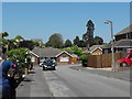
Washbourne Road, Wootton Bassett
Part of a fairly extensive housing development built in the 1960s. The nearby Noremarsh Junior School was built around the same time.
Clarendon Drive is the road at the end and beyond that, on the right, is the town cemetery.
Image: © Penny Mayes
Taken: 22 May 2012
0.23 miles
9

Royal Wootton Bassett : Otter Way Playground
Otter Way Playground is one of seven children's play parks in Royal Wootton Bassett, Wiltshire, managed by the Town Council. The council has initiated the installation of accessible play equipment at this park, aiming to enhance inclusivity for children of all abilities.
Image: © Lewis Clarke
Taken: 4 Mar 2025
0.24 miles
10
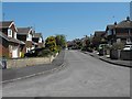
Parsons Way, Wootton Bassett
Viewed from Washbourne Road. Both roads were developed for housing in the 1960s. The nearby Noremarsh Junior School was built around the same time.
Image: © Penny Mayes
Taken: 22 May 2012
0.24 miles