
IMAGES TAKEN NEAR TO
Coombe Close, SWINDON, SN4 0SB
Introduction
This page details the photographs taken nearby to Coombe Close, SN4 0SB by members of the Geograph project.
The Geograph project started in 2005 with the aim of publishing, organising and preserving representative images for every square kilometre of Great Britain, Ireland and the Isle of Man.

There are currently over 7.5m images from over14,400 individuals and you can help contribute to the project by visiting https://www.geograph.org.uk
Image Map
Images are licensed for reuse under creativecommons.org/licenses/by-sa/2.0
Notes
- Clicking on the map will re-center to the selected point.
- The higher the marker number, the further away the image location is from the centre of the postcode.
Image Listing (45 Images Found)
Images are licensed for reuse under creativecommons.org/licenses/by-sa/2.0
Image
Details
Distance
1
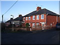
Houses, Overtown Hill, Wroughton
Redbrick houses, probably originally council housing stock.
Image: © Vieve Forward
Taken: 1 Jan 2013
0.03 miles
2
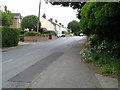
The B4005, Brimble Hill, heading east from Wroughton
Image: © Rob Purvis
Taken: 14 Jun 2013
0.04 miles
3
![Wroughton houses [36]](https://s0.geograph.org.uk/geophotos/06/42/38/6423816_a080a1c3_120x120.jpg)
Wroughton houses [36]
Numbers 26 (nearest the camera) and 27 (at right angles with the gable to the road) Brimble Hill are 18th century thatched cottages, heavily modernised. Listed, grade II, with details at: https://historicengland.org.uk/listing/the-list/list-entry/1023435
The large village of Wroughton lies 2 miles south of Swindon at the foot of the Marlborough Downs escarpment. Two headstreams of the River Ray flow from the downs and meet in the village to run north as Wroughton Stream. There is much evidence of settlement and intensive farming of the area in the Roman period. Originally an agricultural village, most workers now commute into Swindon.
Image: © Michael Dibb
Taken: 11 Mar 2020
0.05 miles
4
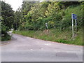
The bottom of Overtown Hill "Unsuitable for HGVs"
Image: © Rob Purvis
Taken: 14 Jun 2013
0.05 miles
5
![Wroughton houses [35]](https://s2.geograph.org.uk/geophotos/06/42/38/6423814_f272fc2f_120x120.jpg)
Wroughton houses [35]
Windshot House, number 45 Marlborough Road, occupies a prominent position at the foot of Brimble Hill.
The large village of Wroughton lies 2 miles south of Swindon at the foot of the Marlborough Downs escarpment. Two headstreams of the River Ray flow from the downs and meet in the village to run north as Wroughton Stream. There is much evidence of settlement and intensive farming of the area in the Roman period. Originally an agricultural village, most workers now commute into Swindon.
Image: © Michael Dibb
Taken: 11 Mar 2020
0.07 miles
7
![Wroughton houses [34]](https://s0.geograph.org.uk/geophotos/06/42/38/6423812_dabad1f2_120x120.jpg)
Wroughton houses [34]
The Knole, number 1 Green's Lane, is a 17th century thatched cottage (centre) with a late 19th or early 20th century extension to the left and a 20th century extension on the right. Listed, grade II, with details at: https://historicengland.org.uk/listing/the-list/list-entry/1023440
The large village of Wroughton lies 2 miles south of Swindon at the foot of the Marlborough Downs escarpment. Two headstreams of the River Ray flow from the downs and meet in the village to run north as Wroughton Stream. There is much evidence of settlement and intensive farming of the area in the Roman period. Originally an agricultural village, most workers now commute into Swindon.
Image: © Michael Dibb
Taken: 11 Mar 2020
0.10 miles
8
![Wroughton houses [33]](https://s1.geograph.org.uk/geophotos/06/42/38/6423801_6c13d1f3_120x120.jpg)
Wroughton houses [33]
Numbers 2 and 3 Green's Lane are a 1768 remodelling of an earlier building. The stone extension to the right is 20th century. Listed, grade II, with details at: https://historicengland.org.uk/listing/the-list/list-entry/1355919
The large village of Wroughton lies 2 miles south of Swindon at the foot of the Marlborough Downs escarpment. Two headstreams of the River Ray flow from the downs and meet in the village to run north as Wroughton Stream. There is much evidence of settlement and intensive farming of the area in the Roman period. Originally an agricultural village, most workers now commute into Swindon.
Image: © Michael Dibb
Taken: 11 Mar 2020
0.10 miles
9
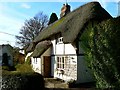
Willow Cottage, Green's Lane, Wroughton, Swindon
The cottage is Grade II listed and has been since 1979. It dates from the 18th century. More information here http://www.imagesofengland.org.uk/details/default.aspx?id=318620
Image: © Brian Robert Marshall
Taken: 12 Nov 2007
0.13 miles
10
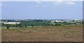
View north from SU154802
The main landmarks visible in this view are, at left, Nationwide Building Society at SU155824 Image and, right, Wakefield House at Image Image In between are Christ Church at Image, the old Corn Exchange at Image and a telecoms mast at Image
Image: © Brian Robert Marshall
Taken: 15 Sep 2006
0.14 miles