Wroughton houses [33]
Introduction
The photograph on this page of Wroughton houses [33] by Michael Dibb as part of the Geograph project.
The Geograph project started in 2005 with the aim of publishing, organising and preserving representative images for every square kilometre of Great Britain, Ireland and the Isle of Man.

There are currently over 7.5m images from over 14,400 individuals and you can help contribute to the project by visiting https://www.geograph.org.uk
Wroughton houses [33]
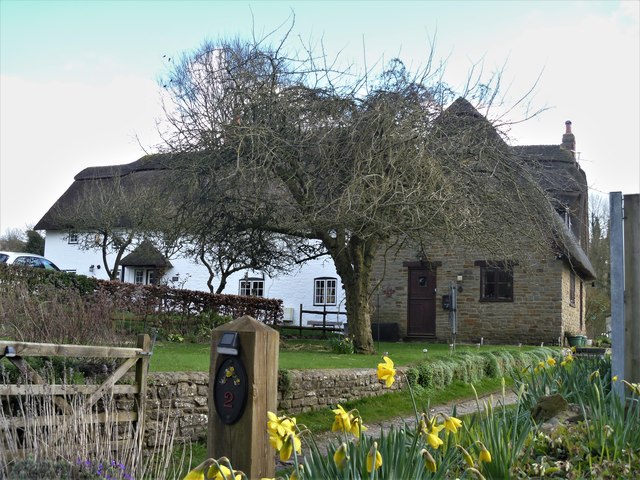
Image: © Michael Dibb Taken: 11 Mar 2020
Numbers 2 and 3 Green's Lane are a 1768 remodelling of an earlier building. The stone extension to the right is 20th century. Listed, grade II, with details at: https://historicengland.org.uk/listing/the-list/list-entry/1355919 The large village of Wroughton lies 2 miles south of Swindon at the foot of the Marlborough Downs escarpment. Two headstreams of the River Ray flow from the downs and meet in the village to run north as Wroughton Stream. There is much evidence of settlement and intensive farming of the area in the Roman period. Originally an agricultural village, most workers now commute into Swindon.
Images are licensed for reuse under creativecommons.org/licenses/by-sa/2.0
Image Location
Latitude
51.520701
Longitude
-1.784914